Login
Register


PUJ
Paulding Northwest Atlanta Airport
Official FAA Data Effective 2026-02-19 0901Z
Chart Supplement

VFR Chart of KPUJ
Sectional Charts at SkyVector.com
IFR Chart of KPUJ
Enroute Charts at SkyVector.com
Location Information for KPUJ
Coordinates: N33°54.72' / W84°56.44'Located 33 miles W of Atlanta, Georgia on 630 acres of land. View all Airports in Georgia.
Surveyed Elevation is 1289 feet MSL.
Operations Data
|
|
Airport Communications
| AWOS-3: | 126.225 Tel. 770-445-3870 |
|---|---|
| ATLANTA APPROACH: | 121.0 268.7 |
| ATLANTA DEPARTURE: | 121.0 268.7 |
| WRGNZ STAR: | 128.575 343.675 |
| BOKRT STAR: | 119.8 354.125 |
| UNICOM: | 123.075 |
| CTAF: | 123.075 |
| AWOS-3PT at VPC (13.0 N): | 120.525 770-607-7782 |
| AWOS-3PT at RYY (18.2 E): | 770-425-3406 |
| ATIS at RYY (18.2 E): | 128.125 |
Nearby Navigation Aids
|
| ||||||||||||||||||||||||||||||||||||||||||||||||||||||||||||


Runway 13/31
| Dimensions: | 5505 x 100 feet / 1678 x 30 meters | |
|---|---|---|
| Surface: | Concrete / Grooved in Good Condition | |
| Weight Limits: | S-90, D-130 | |
| Edge Lighting: | High Intensity | |
| Runway 13 | Runway 31 | |
| Coordinates: | N33°55.00' / W84°56.87' | N33°54.45' / W84°56.01' |
| Elevation: | 1289.0 | 1282.3 |
| Runway Heading: | 127° True | 307° True |
| Markings: | Precision Instrument in good condition. | Precision Instrument in good condition. |
| Glide Slope Indicator | P4L (3.00° Glide Path Angle) | P4L (3.00° Glide Path Angle) |
| REIL: | Yes | Yes |
Services Available
| Fuel: | 100LL (blue), Jet A+ |
|---|---|
| Transient Storage: | Tiedowns |
| Airframe Repair: | MAJOR |
| Engine Repair: | MAJOR |
| Bottled Oxygen: | NONE |
| Bulk Oxygen: | NONE |
| Other Services: | PILOT INSTRUCTION,AIRCRAFT RENTAL |
Ownership Information
| Ownership: | Publicly owned | |
|---|---|---|
| Owner: | PAULDING CO BOARD OF COMMISSIONERS | AND PAULDING COUNTY AIRPORT AUTHORITY |
| 240 CONSTITUTION BLVD | PCAA ADDRESS - 730 AIRPORT PARKWAY, DALLAS, GA 30157 | |
| DALLAS, GA 30132 | ||
| 770-443-7550 | PCAA PHONE - 770-505-7700 | |
| Manager: | NATHANIEL SCHATTNER | |
| 730 AIRPORT PARKWAY, SUITE 100 | ||
| DALLAS, GA 30157 | ||
| 770-505-7700 | ||
Other Remarks
- FOR CD CTC ATLANTA APCH AT 678-364-6131.
- WILDLIFE ON OR INVOF ARPT
- ACTVT REIL RWY 13 & 31; PAPI RWY 13 & 31; HIRL RWY 13/31; TWY LGTS - CTAF.
Weather Minimums


Standard Terminal Arrival (STAR) Charts


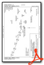

Instrument Approach Procedure (IAP) Charts


Nearby Airports with Instrument Procedures
| ID | Name | Heading / Distance | ||
|---|---|---|---|---|
 |
4A4 | Polk County/Cornelius Moore Field Airport | 302° | 12.0 |
|
KVPC | Cartersville Airport | 019° | 13.4 |
|
KRYY | Cobb County International/Mccollum Field Airport | 070° | 18.2 |
|
KCTJ | West Georgia Regional/O V Gray Field Airport | 212° | 19.8 |
|
KMGE | Dobbins Arb Airport | 089° | 21.3 |
|
KFTY | Fulton County Exec/Charlie Brown Field Airport | 110° | 22.4 |
|
KRMG | Richard B Russell Regional - J H Towers Field Airport | 337° | 28.4 |
|
KATL | Hartsfield/Jackson Atlanta International Airport | 122° | 30.5 |
|
KPDK | Dekalb-Peachtree Airport | 093° | 32.0 |
|
KCZL | Tom B David Field Airport | 000° | 32.5 |
|
KPYP | Centre Piedmont/Cherokee County Regional Airport | 287° | 35.1 |
|
KCNI | Cherokee County Regional Airport | 046° | 35.2 |
Airport Images

By: eyefly27

By: eyefly27


