Login
Register


SCR
Siler City Municipal Airport
Official FAA Data Effective 2025-12-25 0901Z
Chart Supplement

VFR Chart of KSCR
Sectional Charts at SkyVector.com
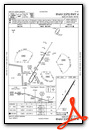
IFR Chart of KSCR
Enroute Charts at SkyVector.com
Location Information for KSCR
Coordinates: N35°42.26' / W79°30.26'Located 03 miles SW of Siler City, North Carolina on 92 acres of land. View all Airports in North Carolina.
Surveyed Elevation is 615 feet MSL.
Operations Data
|
|
Airport Communications
| AWOS-3: | 125.775 Tel. 919-663-1252 |
|---|---|
| GREENSBORO APPROACH: | 126.6 327.075 |
| GREENSBORO DEPARTURE: | 126.6 327.075 |
| CTAF: | 122.700 |
| UNICOM: | 122.700 |
| AWOS-3 at HBI (19.3 W): | 119.275 336-626-7933 |
| ASOS at BUY (20.8 N): | 135.325 336-570-9813 |
| AWOS-3 at TTA (21.0 E): | 120.625 919-708-5382 |
Nearby Navigation Aids
|
| ||||||||||||||||||||||||||||||||||||||||||||||||||||||||||||


Runway 04/22
| Dimensions: | 5000 x 75 feet / 1524 x 23 meters | |
|---|---|---|
| Surface: | Asphalt in Excellent Condition | |
| Weight Limits: | S-25 | |
| Edge Lighting: | Medium Intensity | |
| Runway 04 | Runway 22 | |
| Coordinates: | N35°41.90' / W79°30.52' | N35°42.61' / W79°30.00' |
| Elevation: | 598.5 | 615.1 |
| Traffic Pattern: | Left | Left |
| Runway Heading: | 31° True | 211° True |
| Markings: | Non-Precision Instrument in fair condition. | Non-Precision Instrument in fair condition. |
| Glide Slope Indicator | P4L (4.20° Glide Path Angle) | P4L (3.50° Glide Path Angle) |
| REIL: | Yes | Yes |
| Obstacles: | 45 ft Trees 1183 ft from runway, 247 ft right of center | 48 ft Trees 1283 ft from runway, 249 ft left of center |
Services Available
| Fuel: | 100LL (blue), Jet A-1+ |
|---|---|
| Transient Storage: | Tiedowns |
| Airframe Repair: | MAJOR |
| Engine Repair: | MAJOR |
| Bottled Oxygen: | NOT AVAILABLE |
| Bulk Oxygen: | NONE |
| Other Services: | PILOT INSTRUCTION,AIRCRAFT RENTAL |
Ownership Information
| Ownership: | Publicly owned | |
|---|---|---|
| Owner: | TOWN OF SILER CITY | |
| PO BOX 769 | ||
| SILER CITY, NC 27344 | ||
| 919-742-4731 | ||
| Manager: | KAREN MCCRAW | |
| 80 AVIATION DR. | ||
| SILER CITY, NC 27344 | ||
| 919-742-3847 | ||
Other Remarks
- DEER & BIRDS ON & INVOF ARPT.
- ASPH SECTION OF RAMP PAVEMENT STRENGTH IS CSDRBLY LESS THAN RWY.
- AFT HRS FUEL OR SVCS, CALL 919-619-2707.
- SEASONAL FARMING OPNS AND EQPT INVOF RWY.
- FOR CD CTC GREENSBORO APCH AT 336-333-5119.
- 0LL 24 HR CREDIT CARD SVC AVBL FOR 100LL AND JET A.
- ACTVT REILS RWY 04 & 22; MIRL RWY 04/22 - CTAF. PAPI RWY 04 & 22 OPER CONSLY.
Weather Minimums
Instrument Approach Procedure (IAP) Charts
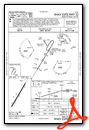
Nearby Airports with Instrument Procedures
| ID | Name | Heading / Distance | ||
|---|---|---|---|---|
 |
KHBI | Asheboro Regional Airport | 261° | 19.3 |
|
KBUY | Burlington/Alamance Regional Airport | 004° | 20.8 |
|
KTTA | Raleigh Exec Jetport At Sanford-Lee County Airport | 110° | 21.0 |
|
43A | Montgomery County Airport | 216° | 23.7 |
|
KSOP | Moore County Airport | 168° | 28.5 |
|
KGSO | Piedmont Triad International Airport | 318° | 31.9 |
|
KVUJ | Stanly County Airport | 241° | 36.0 |
|
KRDU | Raleigh-Durham International Airport | 073° | 36.5 |
|
KEXX | Davidson County Exec Airport | 276° | 39.3 |
|
KPOB | Pope AAF Airport | 142° | 40.0 |
|
KHRJ | Harnett Regional Jetport Airport | 116° | 42.5 |
|
KTDF | Raleigh Regional At Person County Airport | 035° | 43.0 |
Airport Images

By: poitras


