Login
Register


U14
Nephi Municipal Airport
Official FAA Data Effective 2026-02-19 0901Z
Chart Supplement

VFR Chart of U14
Sectional Charts at SkyVector.com
IFR Chart of U14
Enroute Charts at SkyVector.com
Location Information for U14
Coordinates: N39°44.19' / W111°52.20'Located 03 miles NW of Nephi, Utah on 523 acres of land. View all Airports in Utah.
Surveyed Elevation is 5022 feet MSL.
Operations Data
|
|
Airport Communications
| AWOS-3PT: | 118.275 Tel. 435-623-1397 |
|---|---|
| CTAF: | 123.075 |
| UNICOM: | 123.075 |
| AWOS-3PT at SPK (26.3 N): | 119.275 801-804-5801 |
| AWOS-3PT at 41U (27.0 SE): | 120.025 435-283-4624 |
| ATIS at PVU (29.8 N): | 135.175 |
- APCH/DEP CTL SVC PRVDD BY SALT LAKE CITY ARTCC ( ZLC) ON FREQS 127.825/239.025 (FAIRFIELD RCAG & DELTA RCAG) .
Nearby Navigation Aids
|
| ||||||||||||||||||||||||||||||||||||


Runway 17/35
| Dimensions: | 6300 x 100 feet / 1920 x 30 meters | |
|---|---|---|
| Surface: | Asphalt in Fair Condition | |
| Weight Limits: | S-21, D-30 | |
| Edge Lighting: | Medium Intensity | |
| Runway 17 | Runway 35 | |
| Coordinates: | N39°44.71' / W111°52.20' | N39°43.68' / W111°52.20' |
| Elevation: | 4987.0 | 5022.1 |
| Traffic Pattern: | Left | Left |
| Runway Heading: | 179° True | 359° True |
| Markings: | Precision Instrument in fair condition. | Precision Instrument in fair condition. |
| Glide Slope Indicator | P2L (3.00° Glide Path Angle) | P2L (3.00° Glide Path Angle) |
| REIL: | Yes | Yes |
Services Available
| Fuel: | 100LL (blue), Jet-A |
|---|---|
| Transient Storage: | Tiedowns |
| Airframe Repair: | NONE |
| Engine Repair: | NONE |
| Bottled Oxygen: | NONE |
| Bulk Oxygen: | NONE |
| Other Services: | GLIDER SERVICE,PARACHUTE JUMP ACTIVITY |
Ownership Information
| Ownership: | Publicly owned | |
|---|---|---|
| Owner: | CITY OF NEPHI | |
| 1915 N. AIRPORT RD | ||
| NEPHI, UT 84648 | ||
| 435-262-9669 | ||
| Manager: | SCOTT NOLL | |
| 915 N. AIRPORT RD | ||
| NEPHI, UT 84648 | ||
| 435-262-9669 | ||
Other Remarks
- GLDR OPS ON AND INVOF ARPT APR-NOV. 1000 - SS.
- FOR CD CTC SALT LAKE ARTCC AT 801-320-2568.
- PRCHT ACTVT SFC - 18,000 FT MAR-NOV SR-SS.
- 24 HR SELF SVC.
- ACTVT REIL RWY 17 & 35; PAPI RWY 17 & 35; MIRL RWY 17/35 - CTAF.
Weather Minimums


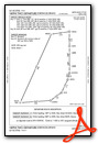
Instrument Approach Procedure (IAP) Charts


Departure Procedure Obstacles (DPO) Charts
Nearby Airports with Instrument Procedures
| ID | Name | Heading / Distance | ||
|---|---|---|---|---|
 |
KSPK | Spanish Fork Municipal/Woodhouse Field Airport | 020° | 26.2 |
|
41U | Sanpete County Regional Airport | 153° | 27.1 |
|
KPVU | Provo Municipal Airport | 013° | 29.7 |
|
KDTA | Delta Municipal Airport | 234° | 36.2 |
|
KHCR | Heber Valley Airport | 024° | 49.1 |
|
69V | Huntington Municipal Airport | 116° | 49.6 |
|
KFOM | Fillmore Municipal Airport | 206° | 52.0 |
|
KPUC | Carbon County Regional/Buck Davis Field Airport | 097° | 52.3 |
|
KTVY | Bolinder Field/Tooele Valley Airport | 337° | 57.0 |
|
KRIF | Richfield Municipal Airport | 190° | 61.1 |
|
KSLC | Salt Lake City International Airport | 355° | 63.3 |
|
KHIF | Hill AFB Airport | 356° | 83.3 |
Airport Images
Do you have a recent image of this airport? Upload it here!


