Login
Register


U69
Duchesne Municipal Airport
Official FAA Data Effective 2025-11-27 0901Z
Chart Supplement

VFR Chart of U69
Sectional Charts at SkyVector.com
IFR Chart of U69
Enroute Charts at SkyVector.com
Location Information for U69
Coordinates: N40°11.62' / W110°22.96'Located 02 miles NE of Duchesne, Utah on 613 acres of land. View all Airports in Utah.
Estimated Elevation is 5830 feet MSL.
Operations Data
|
|
Airport Communications
| AWOS-3: | 121.125 Tel. 435-738-0353 |
|---|---|
| UNICOM: | 122.800 |
| CTAF: | 122.800 |
| AWOS-3P at 74V (16.1 E): | 118.975 435-722-4201 |
| ASOS at PUC (39.1 SW): | 135.425 435-637-2790 |
| ASOS at VEL (42.5 E): | 118.125 435-781-1224 |
- COMMUNICATIONS PRVDD BY CEDAR CITY RADIO ON FREQ 122.1R 112.7T (MYTON RCO).
- APCH/DEP CTL SVC PRVDD BY SALT LAKE ARTCC (ZLC) ON 133.9/370.85 (SUNNYSIDE RCAG).
Nearby Navigation Aids
|
| ||||||||||||||||||||||||||||||||||||

Runway 17/35
| Dimensions: | 5800 x 60 feet / 1768 x 18 meters | |
|---|---|---|
| Surface: | Asphalt in Good Condition | |
| Weight Limits: | S-12 | |
| Edge Lighting: | Medium Intensity | |
| Runway 17 | Runway 35 | |
| Coordinates: | N40°12.07' / W110°23.06' | N40°11.11' / W110°23.06' |
| Elevation: | 5830.9 | 5793.5 |
| Traffic Pattern: | Left | Left |
| Runway Heading: | 180° True | 0 |
| Markings: | Non-Precision Instrument in good condition. | Non-Precision Instrument in good condition. |
| Glide Slope Indicator | P2L (3.00° Glide Path Angle) | P2L (3.00° Glide Path Angle) |
| REIL: | Yes | Yes |
| Obstacles: | 5 ft Fence 360 ft from runway | |
Runway 08/26
| Dimensions: | 3091 x 75 feet / 942 x 23 meters | |
|---|---|---|
| Surface: | Dirt in Fair Condition 3000 FT OF USBL RWY LENGTH EAST OF RWY 17/35. | |
| Runway 08 | Runway 26 | |
| Coordinates: | N40°11.67' / W110°23.09' | N40°11.67' / W110°22.43' |
| Elevation: | 5819.0 | 5798.8 |
| Traffic Pattern: | Left | Left |
| Runway Heading: | 90° True | 270° True |
| Markings: | None in poor condition. | None in poor condition. |
| Obstacles: | 10 ft Road 0 ft from runway, 125 ft right of center 10 FT PVT RD ACRS APCH. |
10 ft Road 0 ft from runway, 125 ft right of center |
Services Available
| Fuel: | 100LL (blue) |
|---|---|
| Transient Storage: | Tiedowns PILOT PRVD OWN ROPES. |
| Airframe Repair: | NONE |
| Engine Repair: | NONE |
| Bottled Oxygen: | NONE |
| Bulk Oxygen: | NONE |
| Other Services: | CROP DUSTING SERVICES |
Ownership Information
| Ownership: | Publicly owned | |
|---|---|---|
| Owner: | CITY OF DUCHESNE | |
| 500 E MAIN, DRAWER 974 | ||
| DUCHESNE, UT 84021 | ||
| 435-738-2464 | ||
| Manager: | RODNEY ROWLEY | |
| 500 E MAIN, DRAWER 974 | ||
| DUCHESNE, UT 84021 | ||
| 435-823-1292 | ||
Other Remarks
- 30 FT PLINES & OIL WELLS WEST SIDE RWY 08.
- 0LL 24 HR SELF SVC. AMERICAN EXPS CREDIT CARD NOT ACPTD.
- ACTVT REIL RWY 17 & 35, PAPI RWY 17 & 35, MIRL RWY 17/35 - CTAF.
Weather Minimums

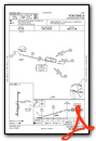
Instrument Approach Procedure (IAP) Charts
Nearby Airports with Instrument Procedures
| ID | Name | Heading / Distance | ||
|---|---|---|---|---|
 |
74V | Roosevelt Municipal Airport | 071° | 16.0 |
|
KPUC | Carbon County Regional/Buck Davis Field Airport | 206° | 38.7 |
|
KVEL | Vernal Regional Airport | 069° | 42.5 |
|
KHCR | Heber Valley Airport | 290° | 51.0 |
|
69V | Huntington Municipal Airport | 206° | 55.7 |
|
KSPK | Spanish Fork Municipal/Woodhouse Field Airport | 267° | 59.2 |
|
KPVU | Provo Municipal Airport | 271° | 61.7 |
|
KEVW | Evanston-Uinta County Burns Field Airport | 335° | 71.3 |
|
KFBR | Fort Bridger Airport | 359° | 71.9 |
|
U14 | Nephi Municipal Airport | 248° | 73.9 |
|
U34 | Green River Municipal Airport | 174° | 74.2 |
|
4V0 | Rangely Airport | 094° | 74.8 |
Airport Images
Do you have a recent image of this airport? Upload it here!


