Login
Register


UKF
Wilkes County Airport
Official FAA Data Effective 2026-02-19 0901Z
Chart Supplement

VFR Chart of KUKF
Sectional Charts at SkyVector.com
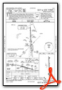
IFR Chart of KUKF
Enroute Charts at SkyVector.com
Location Information for KUKF
Coordinates: N36°13.42' / W81°5.92'Located 04 miles NE of North Wilkesboro, North Carolina on 259 acres of land. View all Airports in North Carolina.
Surveyed Elevation is 1303 feet MSL.
Operations Data
|
|
Airport Communications
| AWOS-3: | 126.625 Tel. 336-696-3788 |
|---|---|
| UNICOM: | 122.700 |
| CTAF: | 122.700 |
| AWOS-3 at GEV (20.0 NW): | 120.675 336-982-5555 |
| AWOS-3PT at TNB (26.8 W): | 119.250 828-268-8921 |
| AWOS-3 at SVH (28.6 S): | 119.225 704-873-1978 |
- APCH/DEP SVC PRVDD BY ATLANTA ARTCC ON FREQS 125.15/263.0 (HICKORY RCAG).
Nearby Navigation Aids
|
| ||||||||||||||||||||||||||||||||||||||||||||||||||||||||||||


Runway 01/19
| Dimensions: | 6201 x 100 feet / 1890 x 30 meters | |
|---|---|---|
| Surface: | Asphalt in Excellent Condition | |
| Weight Limits: | S-45, D-60 | |
| Edge Lighting: | Medium Intensity | |
| Runway 01 | Runway 19 | |
| Coordinates: | N36°12.91' / W81°5.90' | N36°13.93' / W81°5.93' |
| Elevation: | 1247.3 | 1303.4 |
| Runway Heading: | 359° True | 179° True |
| Markings: | Precision Instrument in good condition. | Non-Precision Instrument in good condition. |
| Glide Slope Indicator | P2L (3.00° Glide Path Angle) RWY 01 PAPI UNUSBL BYD 8 DEGS RIGHT OF CNTRLN. | P2L (3.00° Glide Path Angle) |
| Approach Lights: | MALSR 1,400 Foot Medium-intensity Approach Lighting System with runway alignment indicator lights. | |
| REIL: | Yes | |
| Obstacles: | 9 ft Trees 260 ft from runway, 243 ft right of center 10 FT BRUSH 50 FT FM THR OFFSET 436 FT R OF CNTRLN. |
62 ft Trees 632 ft from runway, 329 ft right of center 33 FT TREES 89 FT FM THR OFFSET 285 FT L OF CNTRLN. |
Services Available
| Fuel: | 100LL (blue), Jet A-1+ |
|---|---|
| Transient Storage: | Tiedowns |
| Airframe Repair: | MAJOR |
| Engine Repair: | MAJOR |
| Bottled Oxygen: | HIGH/LOW |
| Bulk Oxygen: | NONE |
| Other Services: | CHARTER SERVICE,PILOT INSTRUCTION |
Ownership Information
| Ownership: | Publicly owned | |
|---|---|---|
| Owner: | WILKES COUNTY | |
| 110 NORTH STREET | ||
| WILKESBORO, NC 28697 | ||
| 336-651-7345 | ||
| Manager: | DUSTIN CAUDILL | |
| 640 WOOD WALLACE | ||
| NORTH WILKESBORO, NC 28659 | ||
| 336-696-2000 | FOR SVC AFT HRS CALL NR POSTED ON DOOR. | |
Other Remarks
- DEER ON & INVOF ARPT.
- NO LINE OF SIGHT BTN RWY ENDS.
- FOR CD IF UNA TO CTC ON FSS FREQ, CTC ATLANTA ARTCC AT 770-210-7692.
- THERE IS AN UNLGTD WATER TANK IN THE APCH OF RWY 01.
- 0LL FUELING DRG RGLR FBO BUS HRS, PLUS 24 HRS CALL-OUT SVC (WITH PRIOR ARNGMT AND/OR A CALLOUT FEE); CALL FBO FOR DETAILS.
- ACTVT MALSR RWY 01; REIL 19; PAPI RWY 01 & 19; MIRL RWY 01/19; TWY LGTS - CTAF.
Weather Minimums

Instrument Approach Procedure (IAP) Charts


Nearby Airports with Instrument Procedures
| ID | Name | Heading / Distance | ||
|---|---|---|---|---|
 |
KZEF | Elkin Municipal Airport | 077° | 15.5 |
|
KGEV | Ashe County Airport | 308° | 19.9 |
|
KSVH | Statesville Regional Airport | 165° | 28.4 |
|
KMWK | Mount Airy/Surry County Airport | 061° | 30.0 |
|
KHKY | Hickory Regional Airport | 206° | 32.2 |
|
KMRN | Foothills Regional Airport | 226° | 34.7 |
|
KHLX | Twin County Airport | 022° | 35.1 |
|
8A7 | Twin Lakes Airport | 120° | 36.3 |
|
6A4 | Johnson County Airport | 288° | 37.1 |
|
14A | Lake Norman Airpark Airport | 165° | 37.8 |
|
KMKJ | Mountain Empire Airport | 343° | 42.0 |
|
KINT | Smith Reynolds Airport | 096° | 42.9 |
Fuel Providers

Airport Images

By: Big Orange Bird

By: Big Orange Bird


