Login
Register


UVA
Garner Field Airport
Official FAA Data Effective 2026-01-22 0901Z
Chart Supplement

VFR Chart of KUVA
Sectional Charts at SkyVector.com
IFR Chart of KUVA
Enroute Charts at SkyVector.com
Location Information for KUVA
Coordinates: N29°12.68' / W99°44.61'Located 03 miles E of Uvalde, Texas on 356 acres of land. View all Airports in Texas.
Surveyed Elevation is 941 feet MSL.
Operations Data
|
|
Airport Communications
| AWOS-3: | 124.175 Tel. 830-278-8862 |
|---|---|
| CTAF: | 122.800 |
| UNICOM: | 122.800 |
| AWOS-3T at U66 (23.6 NE): | 121.125 210-384-5834 |
| ASOS at HDO (30.9 E): | 119.675 830-426-3060 |
| AWOS-3 at CZT (41.7 S): | 119.625 830-876-9243 |
- APCH/DEP CTL SVC PRVDD BY HOUSTON ARTCC (ZHU) ON FREQS 134.95/269.4 (UVALDE RCAG.)
Nearby Navigation Aids
|
| ||||||||||||||||||||||||||||||||||||||||||||||||||||||||||||


Runway 15/33
| Dimensions: | 5256 x 100 feet / 1602 x 30 meters | |
|---|---|---|
| Surface: | Asphalt in Good Condition | |
| Weight Limits: | S-30, D-40, ST-40 | |
| Edge Lighting: | Medium Intensity | |
| Runway 15 | Runway 33 | |
| Coordinates: | N29°13.07' / W99°44.82' | N29°12.29' / W99°44.41' |
| Elevation: | 941.7 | 924.8 |
| Traffic Pattern: | Left | Left |
| Runway Heading: | 155° True | 335° True |
| Markings: | Non-Precision Instrument in good condition. | Non-Precision Instrument in good condition. |
| Glide Slope Indicator | P4L (3.00° Glide Path Angle) | P4L (3.00° Glide Path Angle) |
| REIL: | Yes | Yes |
| Obstacles: | 52 ft Trees 700 ft from runway, 220 ft left of center | |
Services Available
| Fuel: | 100LL (blue), Jet-A |
|---|---|
| Transient Storage: | Hangars,Tiedowns |
| Airframe Repair: | MAJOR |
| Engine Repair: | MAJOR |
| Bottled Oxygen: | HIGH/LOW |
| Bulk Oxygen: | HIGH/LOW |
| Other Services: | CROP DUSTING SERVICES,AVIONICS,CHARTER SERVICE,GLIDER SERVICE,PILOT INSTRUCTION,AIRCRAFT RENTAL,AIRCRAFT SALES,GLIDER TOWING SERVICES |
Ownership Information
| Ownership: | Publicly owned | |
|---|---|---|
| Owner: | CITY OF UVALDE | |
| 101 E MAIN ST, PO BOX 799 | ||
| UVALDE, TX 78802 | ||
| 830-278-3315 | ||
| Manager: | JOE A. CARDENAS | |
| 101 E. MAIN ST., PO BOX 799 | ||
| UVALDE, TX 78802 | ||
| 830-278-3315 | EXTN 101 | |
Other Remarks
- THIS AIRPORT HAS BEEN SURVEYED BY THE NATIONAL GEODETIC SURVEY.
- TURF STRIP 3300 FT X 75 FT PARL TO & EAST OF RWY 15/33 USED BY CROP DUSTERS ONLY.
- FOR CD CTC HOUSTON ARTCC AT 281-230-5622.
- 0LL SELF SVC 100LL.
- ACTVT REIL RWY 15 & 33; MIRL RWY 15/33 - CTAF.
Weather Minimums

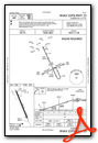
Instrument Approach Procedure (IAP) Charts
Nearby Airports with Instrument Procedures
| ID | Name | Heading / Distance | ||
|---|---|---|---|---|
 |
KHDO | South Texas Regional At Hondo Airport | 073° | 31.0 |
|
T30 | Mc Kinley Field Airport | 124° | 40.7 |
|
KCZT | Dimmit County Airport | 185° | 41.5 |
|
23R | Devine Municipal Airport | 095° | 42.3 |
|
5T9 | Maverick County Memorial International Airport | 242° | 45.7 |
|
KCVB | Castroville Municipal Airport | 080° | 47.5 |
|
KECU | Edwards County Airport | 333° | 49.4 |
|
KCOT | Cotulla-La Salle County Airport | 148° | 53.0 |
|
KDLF | Laughlin AFB Airport | 279° | 55.0 |
|
KERV | Kerrville Municipal/Louis Schreiner Field Airport | 036° | 57.3 |
|
KSKF | Kelly Field Airport | 080° | 61.9 |
|
KDRT | Del Rio International Airport | 279° | 62.9 |
Fuel Providers

Airport Images
Do you have a recent image of this airport? Upload it here!


