Login
Register


T30
Mc Kinley Field Airport
Official FAA Data Effective 2026-01-22 0901Z
Chart Supplement

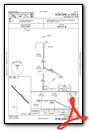
VFR Chart of T30
Sectional Charts at SkyVector.com
IFR Chart of T30
Enroute Charts at SkyVector.com
Location Information for T30
Coordinates: N28°49.34' / W99°6.54'Located 04 miles S of Pearsall, Texas on 141 acres of land. View all Airports in Texas.
Surveyed Elevation is 586 feet MSL.
Operations Data
|
|
Airport Communications
| UNICOM: | 122.800 |
|---|---|
| CTAF: | 122.800 |
| ASOS at COT (22.6 S): | 118.325 830-879-2861 |
| AWOS-3 at PEZ (32.1 E): | 118.575 830-569-5749 |
| ASOS at HDO (32.4 N): | 119.675 830-426-3060 |
- APCH/DEP CTL SVC PRVDD BY HOUSTON ARTCC (ZHU) ON FREQS 134.6/322.5 (THREE RIVERS RCAG).
Nearby Navigation Aids
|
| ||||||||||||||||||||||||||||||||||||||||||||||||||||||||||||


Runway 13/31
| Dimensions: | 5027 x 60 feet / 1532 x 18 meters | |
|---|---|---|
| Surface: | Asphalt in Good Condition | |
| Weight Limits: | S-15
ESTD.
| |
| Edge Lighting: | Low Intensity NSTD LIRL; SPACING 20 FT FM EDGE & 300 FT BTN LGTS. | |
| Runway 13 | Runway 31 | |
| Coordinates: | N28°49.64' / W99°6.86' | N28°49.03' / W99°6.22' |
| Elevation: | 586.4 | 553.8 |
| Traffic Pattern: | Left | Left |
| Runway Heading: | 137° True | 317° True |
| Displaced Threshold: | 168 Feet | 154 Feet |
| Markings: | Basic in poor condition. | Basic in poor condition. |
| Obstacles: | 15 ft Road 201 ft from runway, 76 ft right of center APCH RATIO 22:1 TO DSPLCD THR; 15 FT ROAD 330 FT FM DSPLCD THR 130 FT RIGHT. |
60 ft Power Line 2120 ft from runway RWY 31 APCH RATIO 37:1 TO DSPLCD THR. |
Services Available
| Fuel: | Jet-A |
|---|---|
| Transient Storage: | Tiedowns |
| Airframe Repair: | NONE |
| Engine Repair: | NONE |
| Bottled Oxygen: | NONE |
| Bulk Oxygen: | NONE |
| Other Services: | CROP DUSTING SERVICES |
Ownership Information
| Ownership: | Privately Owned | |
|---|---|---|
| Owner: | AERIAL LLC | |
| BOX 764 | ||
| PEARSALL, TX 78061 | ||
| 830-334-7306 | ||
| Manager: | IKE & NATHAN MC KINLEY | |
| 170 ENCINO | ||
| PEARSALL, TX 78061 | ||
| 830-334-7306 | ALT MGR NUMBER NATHAN MC KINLEY 210-542-0093 | |
Other Remarks
- THIS AIRPORT HAS BEEN SURVEYED BY THE NATIONAL GEODETIC SURVEY.
- FOR CD CTC HOUSTON ARTCC AT 281-230-5622.
- DSPLCD THRS NOT LGTD, 4705 FT AVBL NGT.
- MKGS FADED.
- MKGS FADED.
Weather Minimums
Instrument Approach Procedure (IAP) Charts
Nearby Airports with Instrument Procedures
| ID | Name | Heading / Distance | ||
|---|---|---|---|---|
 |
23R | Devine Municipal Airport | 024° | 20.9 |
|
KCOT | Cotulla-La Salle County Airport | 194° | 22.7 |
|
KPEZ | Pleasanton Municipal Airport | 075° | 32.0 |
|
KHDO | South Texas Regional At Hondo Airport | 353° | 32.3 |
|
KCVB | Castroville Municipal Airport | 023° | 34.0 |
|
KUVA | Garner Field Airport | 305° | 40.7 |
|
KCZT | Dimmit County Airport | 244° | 41.8 |
|
KSKF | Kelly Field Airport | 039° | 43.6 |
|
KSSF | Stinson Municipal Airport | 047° | 45.5 |
|
KSAT | San Antonio International Airport | 038° | 54.3 |
|
5C1 | Boerne Stage Airfield Airport | 021° | 58.1 |
|
8T6 | Live Oak County Airport | 117° | 59.2 |
Airport Images
Do you have a recent image of this airport? Upload it here!


