Login
Register


W75
Hummel Field Airport
Official FAA Data Effective 2026-01-22 0901Z
Chart Supplement

VFR Chart of W75
Sectional Charts at SkyVector.com
IFR Chart of W75
Enroute Charts at SkyVector.com
Location Information for W75
Coordinates: N37°36.22' / W76°26.79'Located 06 miles E of Saluda, Virginia on 80 acres of land. View all Airports in Virginia.
Estimated Elevation is 30 feet MSL.
Operations Data
|
|
Airport Communications
| AWOS-3: | 118.45 Tel. 804-758-8592 |
|---|---|
| NORFOLK APPROACH: | 126.05 370.925 |
| NORFOLK DEPARTURE: | 126.05 370.925 |
| UNICOM: | 123.000 |
| CTAF: | 123.000 |
| AWOS-3 at FYJ (15.8 W): | 132.825 804-785-2307 |
| AWOS-3 at TGI (25.3 NE): | 119.8 757-891-2246 |
| AWOS-3 at JGG (25.4 SW): | 120.625 757-220-8810 |
Nearby Navigation Aids
|
| ||||||||||||||||||||||||||||||||||||||||||||||||||||||||||||


Runway 01/19
| Dimensions: | 3150 x 50 feet / 960 x 15 meters | |
|---|---|---|
| Surface: | Asphalt in Good Condition | |
| Weight Limits: | S-12 | |
| Edge Lighting: | Medium Intensity | |
| Runway 01 | Runway 19 | |
| Coordinates: | N37°35.96' / W76°26.79' | N37°36.48' / W76°26.79' |
| Elevation: | 29.3 | 22.4 |
| Traffic Pattern: | Left | Left |
| Runway Heading: | 0 | 180° True |
| Markings: | Non-Precision Instrument in good condition. | Non-Standard in good condition. |
| Glide Slope Indicator | P2L (4.00° Glide Path Angle) | P2L (4.00° Glide Path Angle) |
| Obstacles: | 92 ft Tree 1463 ft from runway, 173 ft left of center ROAD RUNS PERPENDICULAR TO RWY END. 18 FT BUILDING LOCATED 200 FT FM PAVEMENT END, 204 FT RIGHT OF CENTERLINE. |
67 ft Tree 1713 ft from runway, 178 ft right of center FIELD IMMEDIATELY NORTH OF RWY 19. 7 FT CORN GROWING AT TIMES. |
Services Available
| Fuel: | 100LL (blue) |
|---|---|
| Transient Storage: | Tiedowns |
| Airframe Repair: | MAJOR |
| Engine Repair: | MAJOR |
| Bottled Oxygen: | NONE |
| Bulk Oxygen: | NONE |
| Other Services: | CROP DUSTING SERVICES,PILOT INSTRUCTION,AIRCRAFT RENTAL |
Ownership Information
| Ownership: | Publicly owned | |
|---|---|---|
| Owner: | MIDDLESEX COUNTY | |
| PO BOX 428 | ||
| SALUDA, VA 23149 | ||
| 804-758-4330 | ||
| Manager: | RICHARD M LEWIS | APT PHYSICAL ADDRESS IS: 310 PLANEVIEW ROAD TOPPING, VA 23169 |
| PO BOX 428 | ||
| SALUDA, VA 23149 | ||
| 804-758-4330 | ||
Other Remarks
- TOPPING IS THE CITY CLOSEST TO THE APT. APT IS 2 MILES ENE.
- DRAINAGE SWALES FULL LENGTH OF RY ON BOTH SIDES; USE OF EXIT IN FRONT OF HUMMEL AVIATION ADVISED.
- DEP RWY 01/19: CLIMB TO 500 FT BEFORE ANY TURN OUT; ARR ACFT USE WIDE PAT TO AVOID POPULATED AREAS EAST & WEST OF ARPT.
- BIRDS AND DEER ON & INVOF ARPT DURING WINTER.
- FOR CD CTC NORFOLK APCH AT 757-464-0757.
- ACTVT MIRL RWY 01/19 - CTAF. PAPI RWY 01 & 19 OPS CONSLY.
Weather Minimums

Instrument Approach Procedure (IAP) Charts
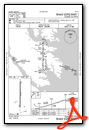
Nearby Airports with Instrument Procedures
| ID | Name | Heading / Distance | ||
|---|---|---|---|---|
 |
KFYJ | Middle Peninsula Regional Airport | 252° | 15.9 |
|
KTGI | Tangier Island Airport | 057° | 25.2 |
|
KJGG | Waltrip Williamsburg Exec Airport Airport | 210° | 25.4 |
|
KXSA | Tappahannock/Essex County Airport | 305° | 26.3 |
|
KPHF | Newport News/Williamsburg International Airport | 184° | 28.4 |
|
KFAF | Felker AAF Airport | 195° | 29.3 |
|
KLFI | Langley AFB Airport | 172° | 31.5 |
|
KMFV | Accomack County Airport | 085° | 32.8 |
|
W96 | New Kent County Airport | 259° | 33.0 |
|
W41 | Crisfield-Somerset County Airport | 049° | 38.5 |
|
KNGU | Norfolk Ns (Chambers Field) Airport | 169° | 40.6 |
|
KNHK | Patuxent River NAS (Trapnell Field) Airport | 002° | 41.0 |
Airport Images
Do you have a recent image of this airport? Upload it here!


