Login
Register


W95
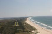
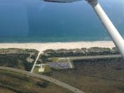
Ocracoke Island Airport
Official FAA Data Effective 2026-02-19 0901Z
Chart Supplement

VFR Chart of W95
Sectional Charts at SkyVector.com
IFR Chart of W95
Enroute Charts at SkyVector.com
Location Information for W95
Coordinates: N35°6.07' / W75°57.96'Located 01 miles E of Ocracoke, North Carolina on 50 acres of land. View all Airports in North Carolina.
Surveyed Elevation is 4 feet MSL.
Operations Data
|
|
Airport Communications
| CHERRY POINT APPROACH: | 119.75 360.775 |
|---|---|
| CHERRY POINT DEPARTURE: | 119.75 360.775 |
| CTAF: | 122.900 |
| ASOS at HSE (18.6 NE): | 118.375 252-552-1005 |
| AWOS-3P at 7W6 (27.5 N): | 119.275 252-925-1136 |
| ASOS at MRH (40.6 SW): | 135.375 252-728-2055 |
Nearby Navigation Aids
|
| ||||||||||||||||||||||||||||||||||||||||||||||||||||||||||||


Runway 06/24
| Dimensions: | 2998 x 60 feet / 914 x 18 meters | |
|---|---|---|
| Surface: | Asphalt in Fair Condition | |
| Weight Limits: | S-30 | |
| Runway 06 | Runway 24 | |
| Coordinates: | N35°5.91' / W75°58.19' | N35°6.23' / W75°57.73' |
| Elevation: | 3.9 | 3.9 |
| Traffic Pattern: | Left | Left |
| Runway Heading: | 50° True | 230° True |
| Markings: | Non-Precision Instrument in fair condition. | Non-Precision Instrument in fair condition. |
| Obstacles: | 5 ft Brush 226 ft from runway, 107 ft left of center 5 FT BRUSH 0-200 FT FM THR 81 FT R OF CNTRLN; 5 FT BRUSH 50-200 FT FM THR 145 FT L OF CNTRLN. |
9 ft Brush 226 ft from runway, 45 ft left of center 12 FT SCRUB TREES 155 FT FM THR 94 FT R OF CNTRLN; 10 FT SCRUB TREES 0-200 FT FM THR 74 FT L OF CNTRLN. |
Helipad H1
BEST APCH FM NE OR SW. | ||
| Dimensions: | 100 x 100 feet / 30 x 30 meters | |
|---|---|---|
| Surface: | Concrete in Good Condition | |
| Edge Lighting: | Perimeter | |
| Coordinates: | N35°6.31' / W75°57.72' | N0°0.00' / E0°0.00' |
| Elevation: | 4.0 | |
| Markings: | Basic in good condition. | |
| Obstacles: | 15 ft Trees 151 ft from runway APCH SLOPE FOR NE HELI APCH IS 13:1 DUE TO 12 FT BRUSH 162 FT FM HELI OFFSET 31 FT L; AND APCH SLOPE FOR SW HELI APCH IS 10:1 DUE TO 15 FT TREES 151 FT FROM HELI OFFSET 0 FT BOTH SIDES. |
|
Services Available
| Fuel: | NONE |
|---|---|
| Transient Storage: | Tiedowns |
| Airframe Repair: | NONE |
| Engine Repair: | NONE |
| Bottled Oxygen: | NONE |
| Bulk Oxygen: | NONE |
Ownership Information
| Ownership: | Publicly owned | |
|---|---|---|
| Owner: | NATIONAL PARK SERVICE | NCDOT DIVISION OF AVIATION COOPERATING AGENCY UNDER MOU; CTC NR 919-814-0550. |
| 1401 NATIONAL PARK DR. | ||
| MANTEO, NC 27954 | ||
| 252-475-9000 | ||
| Manager: | MARK SEAMAN | |
| 1401 NATIONAL PARK DRIVE | ||
| MANTEO, NC 27954 | ||
| 252-475-9000 | NATL PARKS SVC NR ANSWERED 7 DAYS A WEEK BTWN 0800 TO 1700. | |
Other Remarks
- ARPT CLSD 30 MIN AFTER SS TIL 30 MIN BEFORE SR.
- FOR CD CTC WASHINGTON ARTCC AT 703-771-3587.
- 30 FT PLINE ALONG NC HWY 12 N OF HELIPAD.
- HIGH SPEED LOW LEVEL MIL OPS INVOF OF ARPT.
- FLOCKS OF SEAGULLS ON AND NEAR RWY ARND STANDING WATER AFTER HVY RAINS.
- RWY SAFETY AREA IS LOOSE SAND; NOT SUITABLE FOR ACFT.
- RWY NOT LGTD - NIGHT OPS PROHIBITED.
- ARPT IS WI CAPE HATTERAS NTL SEASHORE. MNTN 2000 FT VER & HORIZONTAL DIST FROM SEASHORE BEACHES.
- RWY SUBJ RESIDUAL FLOODING DURG AND AFT HEAVY RAIN.
- KEY CODE ACES TO PILOT LOUNGE.
- HELIPAD FOR EMERG OPS ONLY.
- ACTVT HELI PERIMETER LTS ONLY - CTAF.
- ACTVT HELI BEACON - CTAF.
Instrument Approach Procedure (IAP) Charts


Nearby Airports with Instrument Procedures
| ID | Name | Heading / Distance | ||
|---|---|---|---|---|
 |
KHSE | Billy Mitchell Airport | 065° | 18.9 |
|
7W6 | Hyde County Airport | 001° | 27.6 |
|
KMRH | Michael J Smith Field Airport | 237° | 40.7 |
|
KNKT | Cherry Point MCAS (Cunningham Field) Airport | 255° | 46.6 |
|
KMQI | Dare County Regional Airport | 015° | 50.8 |
|
KEWN | Coastal Carolina Regional Airport | 268° | 53.1 |
|
KFFA | First Flight Airport | 014° | 56.8 |
|
KPMZ | Plymouth Municipal Airport | 317° | 57.6 |
|
KOCW | Washington-Warren Airport | 298° | 60.2 |
|
KEDE | Northeastern Regional Airport | 332° | 62.9 |
|
KECG | Elizabeth City Cg Air Station/Regional Airport | 351° | 70.2 |
|
KMCZ | Martin County Airport | 307° | 74.9 |