Login
Register
X26
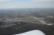
Sebastian Municipal Airport
Official FAA Data Effective 2026-01-22 0901Z
VFR Chart of X26
Sectional Charts at SkyVector.com
IFR Chart of X26
Enroute Charts at SkyVector.com
Location Information for X26
Coordinates: N27°48.80' / W80°29.73'Located 01 miles W of Sebastian, Florida on 620 acres of land. View all Airports in Florida.
Surveyed Elevation is 21 feet MSL.
Operations Data
|
|
Airport Communications
| AWOS-3PT: | 118.125 Tel. 772-228-7020 |
|---|---|
| MIAMI ARTCC APPROACH: | 123.625 ;NORTH 225.4 ;NORTH |
| MIAMI ARTCC DEPARTURE: | 123.625 ;NORTH 225.4 ;NORTH |
| CTAF: | 123.050 |
| AWOS-3PT at X59 (9.6 N): | 119.525 |
| ATIS at VRB (10.3 SE): | 120.575 |
| ASOS at VRB (10.4 SE): | 120.575 772-978-9535 |
Nearby Navigation Aids
|
| ||||||||||||||||||||||||||||||||||||||||||
Runway 05/23
| Dimensions: | 4023 x 75 feet / 1226 x 23 meters | |
|---|---|---|
| Surface: | Asphalt in Excellent Condition | |
| Weight Limits: | 6 /F/B/Y/T, S-22 | |
| Edge Lighting: | Medium Intensity | |
| Runway 05 | Runway 23 | |
| Coordinates: | N27°48.52' / W80°30.02' | N27°48.99' / W80°29.49' |
| Elevation: | 18.4 | 21.5 |
| Traffic Pattern: | Left | Right |
| Runway Heading: | 45° True | 225° True |
| Markings: | Non-Precision Instrument in good condition. | Non-Precision Instrument in good condition. |
| Glide Slope Indicator | P2L | P2L |
| REIL: | Yes | Yes |
| Obstacles: | 37 ft Trees 1090 ft from runway, 120 ft left of center | 45 ft Trees 1520 ft from runway, 135 ft left of center |
Runway 10/28
| Dimensions: | 3199 x 75 feet / 975 x 23 meters | |
|---|---|---|
| Surface: | Asphalt in Fair Condition | |
| Weight Limits: | 6 /F/B/Y/T | |
| Runway 10 | Runway 28 | |
| Coordinates: | N27°48.84' / W80°30.01' | N27°48.84' / W80°29.41' |
| Elevation: | 18.3 | 20.8 |
| Traffic Pattern: | Right | |
| Runway Heading: | 90° True | 270° True |
| Markings: | Basic in good condition. | Basic in good condition. |
| Glide Slope Indicator | P2L | P2L |
| Obstacles: | 29 ft Trees 735 ft from runway, 125 ft left of center RWY 10 APRCH SLOPE 24:1 TO AER. |
20 ft Trees 665 ft from runway, 65 ft right of center |
Services Available
| Fuel: | 100LL (blue) |
|---|---|
| Transient Storage: | Tiedowns |
| Airframe Repair: | MINOR |
| Engine Repair: | MINOR |
| Bottled Oxygen: | NONE |
| Bulk Oxygen: | NONE |
| Other Services: | CHARTER SERVICE,PILOT INSTRUCTION,PARACHUTE JUMP ACTIVITY,AIRCRAFT RENTAL |
Ownership Information
| Ownership: | Publicly owned | |
|---|---|---|
| Owner: | CITY OF SEBASTIAN | CTC PERSON: BRIAN BENTON 772-638-8820 |
| 1225 MAIN STREET | ||
| SEBASTIAN, FL 32958 | ||
| 772-638-8820 | ||
| Manager: | JEFFREY SABO | |
| 202 AIRPORT DRIVE EAST | ||
| SEBASTIAN, FL 32958 | ||
| 772-228-7013 | ||
Other Remarks
- TREES & BRUSH IN ALL TRSN SFCS RWY 5/23.
- NOISE ABATEMENT PROCS IN EFCT: CTC AMGR 772-633-0897.
- IDENTIFICATION RQR FOR ARPT ACCESS.
- EXTSV PRCHT OPNS. AVOID OVERFLYING ARPT DURG PRCHT OPNS.
- FOR CD CTC PALM BEACH APCH AT 561-275-1430
- 0LL FUEL 24 HR CREDIT CARD SVC AVBL.
- PAPI OPRS CONSLY. ACTVT REIL RWY 5 & 23; MIRL RWY 5/23 - CTAF.
Weather Minimums
Instrument Approach Procedure (IAP) Charts
Nearby Airports with Instrument Procedures
| ID | Name | Heading / Distance | ||
|---|---|---|---|---|
 |
X59 | Valkaria Airport | 339° | 9.4 |
 |
KVRB | Vero Beach Regional Airport | 156° | 10.3 |
 |
KMLB | Melbourne Orlando International Airport | 335° | 19.1 |
 |
KFPR | Treasure Coast International Airport | 160° | 20.0 |
 |
KCOF | Patrick Space Force Base Airport | 346° | 26.0 |
 |
KCOI | Merritt Island Airport | 342° | 33.2 |
 |
KOBE | Okeechobee County Airport | 210° | 37.8 |
 |
KXMR | Cape Canaveral Space Force Station Skid Strip Airport | 354° | 39.3 |
 |
KSUA | Witham Field Airport | 158° | 40.5 |
 |
KTIX | Space Coast Regional Airport | 339° | 45.0 |
 |
KTTS | Space Florida Launch and Landing Facility Airport | 347° | 49.1 |
 |
KSEF | Sebring Regional Airport | 244° | 49.9 |


