Login
Register
RPJ
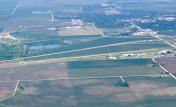
Rochelle Municipal/Koritz Field Airport
Official FAA Data Effective 2024-11-28 0901Z
VFR Chart of KRPJ
Sectional Charts at SkyVector.com
IFR Chart of KRPJ
Enroute Charts at SkyVector.com
Location Information for KRPJ
Coordinates: N41°53.56' / W89°4.78'Located 02 miles S of Rochelle, Illinois on 113 acres of land. View all Airports in Illinois.
Surveyed Elevation is 780 feet MSL.
Operations Data
|
|
Airport Communications
| AWOS-3: | 125.2 Tel. 815-562-2955 |
|---|---|
| ROCKFORD APPROACH: | 126.0 327.0 |
| ROCKFORD DEPARTURE: | 126.0 327.0 |
| UNICOM: | 122.975 |
| CTAF: | 122.975 |
| AWOS-AV at C73 (16.8 W): | 118.575 815-288-2039 |
| AWOS-3 at DKB (16.9 E): | 119.075 815-748-2350 |
| ATIS at RFD (18.2 N): | 127.6 |
Nearby Navigation Aids
|
| ||||||||||||||||||||||||||||||||||||||||||||||||
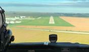
Runway 07/25
RWY 25 CALM WIND RWY. | ||
| Dimensions: | 5001 x 75 feet / 1524 x 23 meters | |
|---|---|---|
| Surface: | Asphalt / Grooved in Good Condition | |
| Weight Limits: | S-15 | |
| Edge Lighting: | Medium Intensity | |
| Runway 07 | Runway 25 | |
| Coordinates: | N41°53.42' / W89°5.29' | N41°53.70' / W89°4.26' |
| Elevation: | 772.2 | 780.9 |
| Traffic Pattern: | Left | Left |
| Runway Heading: | 70° True | 250° True |
| Markings: | Non-Precision Instrument in good condition. | Non-Precision Instrument in good condition. |
| Glide Slope Indicator | P4L (3.00° Glide Path Angle) | P4L (4.00° Glide Path Angle) |
| REIL: | Yes | Yes |
| Obstacles: | 19 ft Road 676 ft from runway, 321 ft left of center | |
Services Available
| Fuel: | 100LL (blue), Jet-A |
|---|---|
| Transient Storage: | Hangars,Tiedowns |
| Airframe Repair: | NOT AVAILABLE |
| Engine Repair: | NOT AVAILABLE |
| Bottled Oxygen: | NOT AVAILABLE |
| Bulk Oxygen: | NOT AVAILABLE |
| Other Services: | AIR FREIGHT SERVICES,PILOT INSTRUCTION |
Ownership Information
| Ownership: | Publicly owned | |
|---|---|---|
| Owner: | CITY OF ROCHELLE | |
| 420 N. 6TH STREET | ||
| ROCHELLE, IL 61068 | ||
| 815-562-6161 | ||
| Manager: | MIKE HUDETZ | |
| 1201 W. GURLER RD. | ||
| ROCHELLE, IL 61068 | ||
| 815-562-8619 | ||
Other Remarks
- PAJA & BIRDS ON AND INVOF ARPT.
- FOR CD CTC CHICAGO ARTCC AT 630-906-8921.
- ACTVT REIL RWY 7 & 25; PAPI RWY 7 & 25 - CTAF. MIRL RWY 7/25; INCR INTST - CTAF.
Weather Minimums
Instrument Approach Procedure (IAP) Charts
Nearby Airports with Instrument Procedures
| ID | Name | Heading / Distance | ||
|---|---|---|---|---|
 |
C73 | Dixon Municipal-Charles R Walgreen Field Airport | 257° | 16.8 |
 |
KDKB | De Kalb Taylor Municipal Airport | 081° | 16.9 |
 |
KRFD | Chicago/Rockford International Airport | 357° | 18.2 |
 |
KARR | Aurora Municipal Airport | 104° | 28.0 |
 |
C77 | Poplar Grove Airport | 022° | 28.0 |
 |
KSQI | Whiteside County/Jos H Bittorf Field Airport | 251° | 28.2 |
 |
KFEP | Albertus Airport | 313° | 30.9 |
 |
KVYS | Illinois Valley Regional-Walter A Duncan Field Airport | 185° | 32.7 |
 |
44C | Beloit Airport | 007° | 36.6 |
 |
KDPA | Dupage Airport | 088° | 37.3 |
 |
3CK | Lake In The Hills Airport | 060° | 38.7 |
 |
C09 | Morris Municipal/James R Washburn Field Airport | 133° | 40.9 |


Comments
Pluses and quirks of KRPJ
Fun airport to fly into, runways and taxiways in good shape. Easy to see. Excellent restaurant w/ friendly staff, a sand volleyball court, and some good "mocktails" for the pilot; can be busy on weekends. Easy-to-use fuel. Be advised that the "intensive parachute activity" warning on the sectional is not idle prose, on a good (i.e. calm enough) day for jumping, esp. in summer, there can be near non-stop Caravans full of jumpers landing and departing, with chutists twirling around the sky. The sectional says to contact KRFD 121.0 for parachute activity advisory, but sometimes there is no NOTAM, and RFD might well tell you to just listen to the Rochelle CTAF. The jump school is pretty good about announcing on the CTAF what they are doing, but they don't always say what pattern they're using. They will say to not overfly the field, so plan a route where you can enter the downwind direct or you will have to give the airfield a wide berth for your teardrop. The jumpers land on the grass between the east end of the runway and the buildings east of the hangars, so if they are descending where they are supposed to, and you have a left pattern to 07, there should be no conflict. Caution is still indicated. A left pattern to 25 requires a little more caution, because you are circling the drop zone, and a straight-in or right pattern might be warranted. • Also be aware that the taxiways do not extend the length of the field; there are 2 intersections near midfield, so a takeoff will either be "short" or require back-taxi, and the latter might require expediting to avoid delaying the drop plane. The length from the intersections is about 3000', plenty for most GA craft.
Pages