Login
Register
59KS
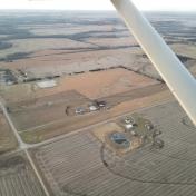
Lamb Ranch Airport
Official FAA Data Effective 2024-12-26 0901Z
VFR Chart of 59KS
Sectional Charts at SkyVector.com
IFR Chart of 59KS
Enroute Charts at SkyVector.com
Location Information for 59KS
Coordinates: N38°1.64' / W95°6.92'Located 03 miles E of Mildred, Kansas. View all Airports in Kansas.
Estimated Elevation is 1009 feet MSL.
Operations Data
|
|
Airport Communications
| AWOS-3PT at K88 (16.0 SW): | 128.325 620-365-1466 |
|---|---|
| AWOS-3P at FSK (21.4 SE): | 124.425 620-215-5899 |
| ASOS at CNU (27.7 SW): | 127.075 620-431-6781 |
Nearby Navigation Aids
|
| ||||||||||||||||||||||||||||||||||||||||||||||||||||||||||||
Runway 18/36
| Dimensions: | 2400 x 35 feet / 732 x 11 meters | |
|---|---|---|
| Surface: | Turf | |
| Runway 18 | Runway 36 | |
| Coordinates: | N38°1.84' / W95°6.91' | N38°1.44' / W95°6.92' |
| Elevation: | 1009.0 | 993.0 |
| Traffic Pattern: | Right | |
Ownership Information
| Ownership: | Privately Owned | |
|---|---|---|
| Owner: | BARRY LAMB | |
| 4594 WEST VIRGINIA RD | ||
| MORAN, KS 66755 | ||
| 620-228-3530 | ||
| Manager: | BARRY LAMB | |
| 4594 WEST VIRGINIA RD | ||
| MORAN, KS 66755 | ||
| 620-228-3530 | ||
Nearby Airports with Instrument Procedures
| ID | Name | Heading / Distance | ||
|---|---|---|---|---|
 |
K88 | Allen County Airport | 233° | 16.0 |
 |
KFSK | Fort Scott Municipal Airport | 129° | 21.4 |
 |
KCNU | Chanute Martin Johnson Airport | 219° | 27.8 |
 |
KOWI | Ottawa Municipal Airport | 348° | 31.4 |
 |
K81 | Miami County Airport | 016° | 32.1 |
 |
KUKL | Coffey County Airport | 299° | 33.2 |
 |
KPTS | Atkinson Municipal Airport | 152° | 39.1 |
 |
KNVD | Nevada Municipal Airport | 104° | 39.9 |
 |
KBUM | Butler Memorial Airport | 066° | 39.9 |
 |
2K7 | Neodesha Municipal Airport | 215° | 43.6 |
 |
KPPF | Tri-City Airport | 204° | 45.7 |
 |
KIXD | New Century Aircenter Airport | 012° | 49.3 |


