Login
Register
2A1
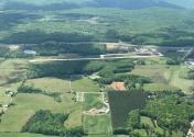
Jamestown Municipal Airport
Official FAA Data Effective 2024-12-26 0901Z
VFR Chart of 2A1
Sectional Charts at SkyVector.com
IFR Chart of 2A1
Enroute Charts at SkyVector.com
Location Information for 2A1
Coordinates: N36°20.98' / W84°56.80'Located 05 miles S of Jamestown, Tennessee on 96 acres of land. View all Airports in Tennessee.
Surveyed Elevation is 1694 feet MSL.
Operations Data
|
|
Airport Communications
| UNICOM: | 122.800 |
|---|---|
| CTAF: | 122.800 |
| AWOS-3 at 8A3 (17.8 W): | 126.175 931-823-3329 |
| AWOS-3 at SCX (18.6 E): | 135.025 423-569-6651 |
| ASOS at CSV (24.8 S): | 120.625 931-456-4406 |
- APCH/DEP SVC PRVDD BY INDIANAPOLIS ARTCC ON FREQS 124.625/371.925 (LONDON 2 RCAG).
Nearby Navigation Aids
|
| ||||||||||||||||||||||||||||||||||||||||||||||||||||||||||||
Runway 01/19
| Dimensions: | 3498 x 75 feet / 1066 x 23 meters | |
|---|---|---|
| Surface: | Asphalt in Excellent Condition | |
| Weight Limits: | S-17, D-22 | |
| Edge Lighting: | Medium Intensity | |
| Runway 01 | Runway 19 | |
| Coordinates: | N36°20.69' / W84°56.80' | N36°21.27' / W84°56.80' |
| Elevation: | 1678.6 | 1694.3 |
| Traffic Pattern: | Left | Left |
| Runway Heading: | 0 | 180° True |
| Markings: | Non-Precision Instrument in fair condition. | Non-Precision Instrument in fair condition. |
| Glide Slope Indicator | P4L (4.00° Glide Path Angle) | P4L (4.00° Glide Path Angle) |
| REIL: | Yes | Yes |
| Obstacles: | 46 ft Tree 941 ft from runway, 2 ft left of center | 90 ft Tree 1803 ft from runway, 438 ft right of center |
Services Available
| Fuel: | 100LL (blue) |
|---|---|
| Transient Storage: | Hangars,Tiedowns |
| Airframe Repair: | NONE |
| Engine Repair: | MAJOR |
| Bottled Oxygen: | NOT AVAILABLE |
| Bulk Oxygen: | NOT AVAILABLE |
| Other Services: | PILOT INSTRUCTION,AIRCRAFT RENTAL |
Ownership Information
| Ownership: | Publicly owned | |
|---|---|---|
| Owner: | CITY OF JAMESTOWN | |
| CITY HALL PO BOX 670 | ||
| JAMESTOWN, TN 38556 | ||
| 931-879-8815 | ||
| Manager: | RONNIE SEAGRAVES | |
| 125 AIRPORT RD | ||
| JAMESTOWN, TN 38556 | ||
| 931-879-8948 | AFT HR - 931-879-5685. | |
Other Remarks
- FOR CD CTC INDIANAPOLIS ARTCC AT 317-247-2411.
- ACTVT REIL RWY 01 & 19; MIRL 01/19 - CTAF. MIRL 01/19 INCR INTST - CTAF. PAPI RWY 01 & 19 ON CONSLY.
Weather Minimums
Instrument Approach Procedure (IAP) Charts
Nearby Airports with Instrument Procedures
| ID | Name | Heading / Distance | ||
|---|---|---|---|---|
 |
8A3 | Livingston Municipal Airport | 282° | 18.0 |
 |
KSCX | Scott Municipal Airport | 069° | 18.6 |
 |
KCSV | Crossville Memorial-Whitson Field Airport | 195° | 24.8 |
 |
KRKW | Rockwood Municipal Airport | 153° | 28.5 |
 |
KEKQ | Wayne County Airport | 008° | 30.6 |
 |
KSRB | Upper Cumberland Regional Airport | 238° | 33.3 |
 |
18I | Mc Creary County Airport | 052° | 33.9 |
 |
KJAU | Colonel Tommy C Stiner Airfield Airport | 091° | 38.0 |
 |
K24 | Russell County Airport | 349° | 40.3 |
 |
KTZV | Tompkinsville/Monroe County Airport | 303° | 41.0 |
 |
KBYL | Williamsburg-Whitley County Airport | 053° | 44.9 |
 |
KSME | Lake Cumberland Regional Airport | 020° | 45.1 |


