Login
Register
RZL
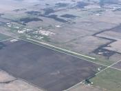
Jasper County Airport
Official FAA Data Effective 2025-02-20 0901Z
VFR Chart of KRZL
Sectional Charts at SkyVector.com
IFR Chart of KRZL
Enroute Charts at SkyVector.com
Location Information for KRZL
Coordinates: N40°56.87' / W87°10.96'Located 01 miles NW of Rensselaer, Indiana on 132 acres of land. View all Airports in Indiana.
Surveyed Elevation is 698 feet MSL.
Operations Data
|
|
Airport Communications
| AWOS-3P: | 119.175 Tel. 219-866-7167 |
|---|---|
| CTAF: | 122.800 |
| UNICOM: | 122.800 |
| AWOS-3P at MCX (23.7 SE): | 124.05 574-583-0531 |
| AWOS-3 at IKK (31.0 W): | 128.475 815-939-4044 |
| ASOS at VPZ (31.4 N): | 125.875 219-531-1770 |
- APCH/DEP SVC PRVDD BY CHICAGO ARTCC (ZAU) ON FREQS 132.5/284.7 (KANKAKEE RCAG).
Nearby Navigation Aids
|
| ||||||||||||||||||||||||||||||||||||||||||||||||||||||||||||
Runway 18/36
| Dimensions: | 4000 x 60 feet / 1219 x 18 meters | |
|---|---|---|
| Surface: | Concrete in Good Condition | |
| Weight Limits: | S-12 | |
| Edge Lighting: | Medium Intensity | |
| Runway 18 | Runway 36 | |
| Coordinates: | N40°57.21' / W87°10.89' | N40°56.55' / W87°10.89' |
| Elevation: | 698.2 | 674.4 |
| Traffic Pattern: | Left | Left |
| Runway Heading: | 180° True | 360° True |
| Markings: | Non-Precision Instrument in fair condition. | Non-Precision Instrument in fair condition. |
| Glide Slope Indicator | P2L (3.00° Glide Path Angle) | P2L (3.00° Glide Path Angle) |
| REIL: | Yes | Yes |
| Obstacles: | 29 ft Road 790 ft from runway | 15 ft Road 520 ft from runway CROPS 120 FT R OF CNTRLN AT THR; ROAD 245 FT R OF CNTRLN. TIE-DOWN AREA 100 FT FM RWY END 130 FT L OF CNTRLN. |
Runway 09/27
| Dimensions: | 1450 x 150 feet / 442 x 46 meters | |
|---|---|---|
| Surface: | Turf in Good Condition | |
| Runway 09 | Runway 27 | |
| Coordinates: | N40°56.85' / W87°11.31' | N40°56.85' / W87°11.00' |
| Elevation: | 678.9 | 684.1 |
| Traffic Pattern: | Left | Left |
| Runway Heading: | 89° True | 269° True |
| Markings: | None | None |
Services Available
| Fuel: | 100LL (blue), Jet A+ |
|---|---|
| Transient Storage: | Hangars,Tiedowns |
| Airframe Repair: | MAJOR |
| Engine Repair: | MAJOR |
| Bottled Oxygen: | NOT AVAILABLE |
| Bulk Oxygen: | NOT AVAILABLE |
| Other Services: | PILOT INSTRUCTION,AIRCRAFT RENTAL |
Ownership Information
| Ownership: | Publicly owned | |
|---|---|---|
| Owner: | JASPER COUNTY AIRPORT AUTHORITY | |
| 2326 W. CLARK ST. | ||
| RENSSELAER, IN 47978 | ||
| 219-866-2100 | ||
| Manager: | EMILY HACKLER | |
| 2326 W. CLARK ST. | ||
| RENSSELAER, IN 47978 | ||
| 219-866-2100 | 219-869-5103. | |
Other Remarks
- COND UNMNT 1700-0800.
- FOR CD CTC CHICAGO ARTCC AT 630-906-8921.
- ORANGE CONES.
- ORANGE CONES.
- 0LL SELF SVC FUEL H24 WITH CREDIT CARD.
- ACTVT REIL RWY 18 & 36; MIRL RWY 18/36 - CTAF. PAPI RWY 18 & 36 ON CONSLY.
Weather Minimums
Instrument Approach Procedure (IAP) Charts
Nearby Airports with Instrument Procedures
| ID | Name | Heading / Distance | ||
|---|---|---|---|---|
 |
50I | Kentland Municipal Airport | 224° | 16.0 |
 |
KMCX | White County Airport | 126° | 23.7 |
 |
KRWN | Arens Field Airport | 071° | 27.3 |
 |
KIKK | Greater Kankakee Airport | 284° | 31.0 |
 |
KVPZ | Porter County Regional Airport | 014° | 31.4 |
 |
KOXI | Starke County Airport | 045° | 32.8 |
 |
1I9 | Delphi Municipal Airport | 136° | 33.4 |
 |
KLAF | Purdue University Airport | 160° | 34.0 |
 |
C56 | Bult Field Airport | 318° | 34.2 |
 |
05C | Griffith-Merrillville Airport | 344° | 35.7 |
 |
3HO | Hobart Sky Ranch Airport | 354° | 36.6 |
 |
KIGQ | Lansing Municipal Airport | 336° | 38.5 |


