Login
Register
9G2
Prices Airport
Official FAA Data Effective 2024-12-26 0901Z
VFR Chart of 9G2
Sectional Charts at SkyVector.com
IFR Chart of 9G2
Enroute Charts at SkyVector.com
Location Information for 9G2
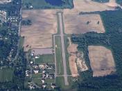
Coordinates: N42°48.46' / W83°46.14'Located 01 miles S of Linden, Michigan on 70 acres of land. View all Airports in Michigan.
Estimated Elevation is 919 feet MSL.
Operations Data
|
|
Airport Communications
| GREAT LAKES APPROACH: | 128.55 257.9 |
|---|---|
| GREAT LAKES DEPARTURE: | 128.55 257.9 |
| CTAF: | 123.000 |
| UNICOM: | 123.000 |
| ATIS at FNT (9.5 N): | 133.15 |
| ASOS at FNT (9.6 N): | 810-342-7804 |
| AWOS-3 at OZW (14.3 SW): | 118.875 517-546-4450 |
- APCH/DEP SVC PRVDD BY CLEVELAND ARTCC (ZOB) ON FREQS 126.75/348.75 (FLINT RCAG) WHEN GREAT LAKES APCH CTL CLSD.
Nearby Navigation Aids
|
| ||||||||||||||||||||||||||||||||||||||||||||||||||||||||||||
Runway 09/27
| Dimensions: | 3999 x 75 feet / 1219 x 23 meters | |
|---|---|---|
| Surface: | Asphalt in Fair Condition | |
| Edge Lighting: | Medium Intensity | |
| Runway 09 | Runway 27 | |
| Coordinates: | N42°48.45' / W83°46.58' | N42°48.46' / W83°45.69' |
| Elevation: | 919.4 | 905.7 |
| Traffic Pattern: | Left | Left |
| Runway Heading: | 89° True | 269° True |
| Displaced Threshold: | 267 Feet | 800 Feet |
| Markings: | Non-Precision Instrument in fair condition. | Non-Precision Instrument in fair condition. |
| REIL: | Yes | |
| Obstacles: | 36 ft Trees 200 ft from runway, 250 ft right of center CTLG OBSTN EXCEEDS A 45 DEG SLP. APCH RATIO 12:1 TO DTHR OVR +36 FT TREE, 467 FT DIST, 250 FT R. -7 FT POND, 140 FT DIST. |
36 ft Trees 356 ft from runway, 133 ft left of center APCH RATIO 20:1 TO DTHR. |
Services Available
| Fuel: | 100LL (blue) |
|---|---|
| Transient Storage: | Hangars,Tiedowns |
| Airframe Repair: | MAJOR PRIOR ARNGMT. |
| Engine Repair: | MAJOR |
| Bottled Oxygen: | NOT AVAILABLE |
| Bulk Oxygen: | NOT AVAILABLE |
Ownership Information
| Ownership: | Privately Owned | |
|---|---|---|
| Owner: | 9G2 LLC | |
| 15057 LINDBERGH CT | ||
| LINDEN, MI 48451-9054 | ||
| 586-946-5381 | ||
| Manager: | CODY WELCH | |
| 15057 LINDBERGH CT | ||
| LINDEN, MI 48451-9054 | ||
| 586-946-5381 | ||
Other Remarks
- DEER & LRG BIRDS ON & INVOF ARPT.
- FOR CD CTC GREAT LAKES APCH AT 269-459-3345, WHEN APCH CLSD CTC CLEVELAND ARTCC AT 440-774-0229/0490.
- ACTVT REIL RWY 09; MIRL RWY 09/27 - CTAF.
Weather Minimums
Instrument Approach Procedure (IAP) Charts
Nearby Airports with Instrument Procedures
| ID | Name | Heading / Distance | ||
|---|---|---|---|---|
 |
KFNT | Bishop International Airport | 006° | 9.5 |
 |
KOZW | Livingston County Spencer J Hardy Airport | 221° | 14.3 |
 |
KPTK | Oakland County International Airport | 118° | 17.6 |
 |
Y47 | Oakland Southwest Airport | 160° | 19.4 |
 |
KRNP | Owosso Community Airport | 304° | 19.7 |
 |
D95 | Dupont/Lapeer Airport | 054° | 26.9 |
 |
KVLL | Oakland/Troy Airport | 121° | 30.6 |
 |
1D2 | Canton-Plymouth-Mettetal Airport | 153° | 30.9 |
 |
KTEW | Mason Jewett Field Airport | 243° | 32.4 |
 |
D98 | Romeo State Airport | 090° | 35.1 |
 |
KARB | Ann Arbor Municipal Airport | 178° | 35.1 |
 |
KYIP | Willow Run Airport | 162° | 35.6 |


