Login
Register
17A
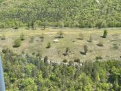
Trigger Gap Airport
Official FAA Data Effective 2024-12-26 0901Z
VFR Chart of 17A
Sectional Charts at SkyVector.com
IFR Chart of 17A
Enroute Charts at SkyVector.com
Location Information for 17A
Coordinates: N36°19.69' / W93°37.33'Located 05 miles SW of Berryville, Arkansas. View all Airports in Arkansas.
Estimated Elevation is 1650 feet MSL.
Operations Data
|
|
Airport Communications
| CTAF: | 122.900 |
|---|---|
| ASOS at HRO (23.0 E): | 121.125 870-365-8550 |
| AWOS-3PT at ROG (23.6 W): | 134.375 479-631-9196 |
| AWOS-3 at BBG (23.8 NE): | 124.625 417-334-0218 |
Nearby Navigation Aids
|
| ||||||||||||||||||||||||||||||||||||||||||||||||||||||
Runway 10/28
| Dimensions: | 3000 x 75 feet / 914 x 23 meters | |
|---|---|---|
| Surface: | Turf in Good Condition | |
| Runway 10 | Runway 28 | |
| Coordinates: | N36°19.76' / W93°37.63' | N36°19.63' / W93°37.04' |
| Elevation: | 1608.0 | 1650.0 |
| Traffic Pattern: | Right | Left |
| Runway Heading: | 105° True | 285° True |
| Obstacles: | 23 ft Tree 250 ft from runway, 55 ft left of center | 50 ft Trees 150 ft from runway |
Ownership Information
| Ownership: | Publicly owned | |
|---|---|---|
| Owner: | RECREATIONAL AVIATION FOUNDATION | |
| 1711 W COLLEGE STREET | ||
| BOZEMAN, MT 59715 | ||
| 406-582-1723 | ||
| Manager: | HARPER GOODWIN | |
| P.O. BOX 791 | ||
| EUREKA SPRINGS, AR 72632 | ||
| 817-938-3334 | ||
Other Remarks
- FOR CD CTC RAZORBACK APCH 479-649-2416, WHEN APCH CLSD CTC MEMPHIS ARTCC AT 901-368-8453/8449.
- DEER ON & INVOF ARPT
Nearby Airports with Instrument Procedures
| ID | Name | Heading / Distance | ||
|---|---|---|---|---|
 |
4M1 | Carroll County Airport | 357° | 3.2 |
 |
H34 | Huntsville Municipal Airport | 203° | 16.3 |
 |
KHRO | Boone County Airport | 099° | 23.0 |
 |
KROG | Rogers Exec - Carter Field Airport | 276° | 23.6 |
 |
KBBG | Branson Airport | 058° | 23.8 |
 |
KFWB | Branson West Municipal/Emerson Field Airport | 025° | 24.6 |
 |
KASG | Springdale Municipal Airport | 249° | 25.8 |
 |
94K | Cassville Municipal Airport | 328° | 25.9 |
 |
KPLK | M Graham Clark Downtown Airport | 046° | 26.1 |
 |
KVBT | Bentonville Municipal/Louise M Thaden Field Airport | 272° | 29.0 |
 |
KFYV | Drake Field Airport | 234° | 32.9 |
 |
KXNA | Northwest Arkansas Ntl Airport | 265° | 33.4 |


