Login
Register


AUM
Austin Municipal Airport
Official FAA Data Effective 2026-02-19 0901Z
Chart Supplement

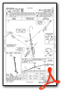
VFR Chart of KAUM
Sectional Charts at SkyVector.com
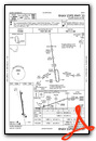
IFR Chart of KAUM
Enroute Charts at SkyVector.com
Location Information for KAUM
Coordinates: N43°39.76' / W92°55.98'Located 02 miles E of Austin, Minnesota on 278 acres of land. View all Airports in Minnesota.
Surveyed Elevation is 1233 feet MSL.
Operations Data
|
|
Airport Communications
| AWOS-3PT: | 119.025 Tel. 507-433-6667 |
|---|---|
| ROCHESTER APPROACH: | 119.8 251.125 |
| ROCHESTER DEPARTURE: | 119.8 251.125 |
| UNICOM: | 122.700 |
| CTAF: | 122.700 |
| AWOS-3PT at AEL (19.1 W): | 119.575 507-377-1583 |
| AWOS-3PT at TOB (21.9 N): | 119.075 507-374-6369 |
| ATIS at RST (23.9 NE): | 120.5 |
- APCH/DEP SVC PRVDD BY MINNEAPOLIS ARTCC ON FREQS 132.35/307.3 (ROCHESTER RCAG) WHEN ROCHESTER APCH CTL CLSD.
Nearby Navigation Aids
|
| ||||||||||||||||||||||||||||||||||||||||||||||||


Runway 17/35
| Dimensions: | 5800 x 100 feet / 1768 x 30 meters | |
|---|---|---|
| Surface: | Concrete in Good Condition | |
| Weight Limits: | 48 /R/C/W/T, S-100, D-135 | |
| Edge Lighting: | High Intensity | |
| Runway 17 | Runway 35 | |
| Coordinates: | N43°40.23' / W92°56.07' | N43°39.29' / W92°55.89' |
| Elevation: | 1231.0 | 1230.8 |
| Traffic Pattern: | Left | Left |
| Runway Heading: | 172° True | 352° True |
| Markings: | Precision Instrument in good condition. | Precision Instrument in good condition. |
| Glide Slope Indicator | P4L (3.00° Glide Path Angle) | P4L (3.00° Glide Path Angle) |
| Approach Lights: | MALSR 1,400 Foot Medium-intensity Approach Lighting System with runway alignment indicator lights. | |
| REIL: | Yes | |
| Obstacles: | 80 ft Trees 1705 ft from runway, 607 ft right of center | |
Services Available
| Fuel: | 100LL (blue), Jet-A |
|---|---|
| Transient Storage: | Hangars,Tiedowns |
| Airframe Repair: | MAJOR |
| Engine Repair: | MAJOR |
| Bottled Oxygen: | NONE |
| Bulk Oxygen: | NONE |
| Other Services: | PILOT INSTRUCTION,AIRCRAFT RENTAL,AIRCRAFT SALES |
Ownership Information
| Ownership: | Publicly owned | |
|---|---|---|
| Owner: | CITY OF AUSTIN | |
| 500 4TH AV NE | ||
| AUSTIN, MN 55912-3773 | ||
| 507-437-7674 | ||
| Manager: | BRUCE W BUDAHN | |
| 710 21ST ST NE | ||
| AUSTIN, MN 55912-4165 | ||
| 507-433-1813 | 507-433-1813. | |
Other Remarks
- MIGRATORY WATERFOWL & DEER INVOF ARPT.
- FOR CD CTC ROCHESTER APCH AT 507-424-8111.
- 0LL AFT HRS CTC FBO 507-433-1813.
- ACTVT MALSR RWY 35; REIL RWY 17; PAPI RWY 17 & 35; HIRL RWY 17/35 DALGT - CTAF. HIRL RWY 17/35 PRESET LOW INTST AT NIGHT; TO INCR INTST - CTAF.
Weather Minimums


Instrument Approach Procedure (IAP) Charts

Nearby Airports with Instrument Procedures
| ID | Name | Heading / Distance | ||
|---|---|---|---|---|
 |
KAEL | Albert Lea Municipal Airport | 273° | 19.0 |
|
KTOB | Dodge Center Airport | 011° | 21.8 |
|
KRST | Rochester International Airport | 051° | 23.9 |
|
KOWA | Owatonna Degner Regional Airport | 332° | 31.0 |
|
KFKA | Fillmore County Airport | 088° | 32.8 |
|
KMCW | Mason City Municipal Airport | 210° | 34.9 |
|
KACQ | Waseca Municipal/Maynard Richard Stensrud Field Airport | 312° | 36.5 |
|
KCCY | Northeast Iowa Regional Airport | 158° | 38.1 |
|
KCJJ | Ellen Church Field Airport | 116° | 39.2 |
|
KFXY | Forest City Municipal/Trimble Field Airport | 229° | 39.6 |
|
KFBL | Faribault Municipal-Liz Wall Strohfus Field Airport | 337° | 43.2 |
|
55Y | Rushford Municipal/Robert W Bunke Field Airport | 078° | 48.8 |
Airport Images
Do you have a recent image of this airport? Upload it here!


Comments
Courtesy car to SPAM Museum
The FBO has a courtesy car that you drive to the SPAM Museum at the Hormel plant. It's small but has a lot of cool stuff and it's free!