Login
Register


GEO
Brown County Airport
Official FAA Data Effective 2026-02-19 0901Z
Chart Supplement

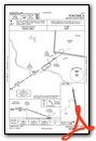
VFR Chart of KGEO
Sectional Charts at SkyVector.com
IFR Chart of KGEO
Enroute Charts at SkyVector.com
Location Information for KGEO
Coordinates: N38°52.92' / W83°52.96'Located 01 miles NE of Georgetown, Ohio on 42 acres of land. View all Airports in Ohio.
Surveyed Elevation is 957 feet MSL.
Operations Data
|
|
Airport Communications
| CTAF: | 122.900 |
|---|---|
| AWOS-3 at I69 (19.2 NW): | 127.275 513-732-6978 |
| AWOS-3 at FGX (21.6 S): | 118.125 606-742-2008 |
| AWOS-3 at HOC (24.4 NE): | 118.175 937-393-9038 |
- APCH/DEP SVC PRVDD BY INDIANAPOLIS ARTCC ON FREQS 135.575/290.5 (MERWYN RCAG).
Nearby Navigation Aids
|
| ||||||||||||||||||||||||||||||||||||||||||||||||||||||||||||


Runway 18/36
| Dimensions: | 3530 x 65 feet / 1076 x 20 meters | |
|---|---|---|
| Surface: | Asphalt in Fair Condition | |
| Edge Lighting: | Medium Intensity | |
| Runway 18 | Runway 36 | |
| Coordinates: | N38°53.20' / W83°53.03' | N38°52.63' / W83°52.90' |
| Elevation: | 955.6 | 953.3 |
| Traffic Pattern: | Left | Left |
| Runway Heading: | 170° True | 350° True |
| Markings: | Non-Precision Instrument in fair condition. | Non-Precision Instrument in fair condition. |
| Glide Slope Indicator | P4L (3.03° Glide Path Angle) | P4L (3.03° Glide Path Angle) |
| REIL: | Yes | Yes |
| Obstacles: | 100 ft Trees 854 ft from runway, 186 ft right of center ALSO 10 FT ROAD, 300 FT FM, 0 B, APCH RATIO 10:1. |
40 ft Tree 438 ft from runway, 245 ft right of center |
Services Available
| Fuel: | 100LL (blue), UL94 |
|---|---|
| Transient Storage: | Hangars,Tiedowns TSNT HNGR, PRIOR CDN RQRD, TIEDOWN NO ROPES PRVDD. |
| Airframe Repair: | NOT AVAILABLE FOR AIRFRAME & POWERPLANT REPAIRS PHONE 937-379-1055. |
| Engine Repair: | NOT AVAILABLE |
| Bottled Oxygen: | NONE |
| Bulk Oxygen: | NONE |
Ownership Information
| Ownership: | Publicly owned | |
|---|---|---|
| Owner: | BROWN CO COMM | |
| BROWN COUNTY COURTHOUSE | ||
| GEORGETOWN, OH 45121 | ||
| 937-378-3956 | ||
| Manager: | STEVE AND SANDY MCKINNEY | |
| 8862 AIRPORT ROAD | ||
| GEORGETOWN, OH 45121 | ||
| 937-483-6212 | ADNL CTC: HOME 937-379-1634; BUS 937-379-1055. SPMCKINNEY53@GMAIL.COM | |
Other Remarks
- THIS AIRPORT HAS BEEN SURVEYED BY THE NATIONAL GEODETIC SURVEY.
- FOR CD CTC INDIANAPOLIS ARTCC AT 317-247-2411.
- 0LL SELF SERVICE FUEL AVBL 24 HRS WITH CREDIT CARD.
- ACTVT REIL RWY 18 & 36; MIRL RWY 18/36 - CTAF.
Weather Minimums

Instrument Approach Procedure (IAP) Charts

Nearby Airports with Instrument Procedures
| ID | Name | Heading / Distance | ||
|---|---|---|---|---|
 |
KAMT | Alexander Salamon Airport | 096° | 15.0 |
|
I69 | Clermont County Airport | 307° | 19.3 |
|
KFGX | Fleming-Mason Airport | 162° | 21.4 |
|
KHOC | Highland County Airport | 041° | 24.4 |
|
K62 | Gene Snyder Airport | 246° | 26.2 |
|
KLUK | Cincinnati Municipal/Lunken Field Airport | 298° | 28.3 |
|
KILN | Wilmington Air Park Airport | 007° | 33.0 |
|
0I8 | Cynthiana-Harrison County Airport | 211° | 36.2 |
|
I66 | Clinton Field Airport | 001° | 37.2 |
|
KCVG | Cincinnati/Northern Kentucky International Airport | 285° | 38.1 |
|
I68 | Warren County/John Lane Field Airport | 333° | 38.8 |
|
KHAO | Butler County Regional/Hogan Field Airport | 314° | 41.5 |
Airport Images
Do you have a recent image of this airport? Upload it here!


