Login
Register


GNV
Gainesville Regional Airport
Official FAA Data Effective 2026-01-22 0901Z
Chart Supplement

KGNV Airport Diagram

VFR Chart of KGNV
Sectional Charts at SkyVector.com
IFR Chart of KGNV
Enroute Charts at SkyVector.com
Location Information for KGNV
Coordinates: N29°41.40' / W82°16.31'Located 03 miles NE of Gainesville, Florida on 1650 acres of land. View all Airports in Florida.
Surveyed Elevation is 151 feet MSL.
Operations Data
|
|
Airport Communications
| ATIS: | 127.15 |
|---|---|
| ASOS: | 127.15 Tel. 352-335-8672 |
| GAINESVILLE TOWER: | 119.55 353.7 |
| GAINESVILLE GROUND: | 121.7 |
| JACKSONVILLE APPROACH: | 118.175 ;10000 FT & BLW 338.25 |
| JACKSONVILLE DEPARTURE: | 118.175 ;10000 FT & BLW 338.25 |
| CTAF: | 119.550 |
| UNICOM: | 122.950 |
| AWOS-3 at 42J (15.0 NE): | 124.275 352-473-8273 |
| AWOS-3T at X60 (22.4 SW): | 118.425 352-528-9949 |
| AWOS-3 at 28J (30.4 E): | 119.925 386-312-2212 |
Nearby Navigation Aids
|
| ||||||||||||||||||||||||||||||||||||||||||||||||


Runway 11/29
| Dimensions: | 7504 x 150 feet / 2287 x 46 meters | |
|---|---|---|
| Surface: | Asphalt / Grooved in Good Condition STD GROOVING FULL LENGTH AND 130 FT WIDE CENTER PORTION. | |
| Weight Limits: | S-118, D-195, ST-331, DT-796
PCR VALUE: 480/F/B/X/T
| |
| Edge Lighting: | High Intensity | |
| Runway 11 | Runway 29 | |
| Coordinates: | N29°41.43' / W82°16.84' | N29°41.17' / W82°15.45' |
| Elevation: | 147.4 | 105.1 |
| Runway Heading: | 102° True | 282° True |
| Markings: | Precision Instrument in good condition. | Precision Instrument in good condition. |
| Glide Slope Indicator | P4L (3.00° Glide Path Angle) | P4R (3.00° Glide Path Angle) |
| RVR Equipment | Rollout | Touchdown |
| Approach Lights: | MALSR 1,400 Foot Medium-intensity Approach Lighting System with runway alignment indicator lights. | |
| REIL: | Yes | |
| Obstacles: | 81 ft Trees 2783 ft from runway, 626 ft right of center | 68 ft Trees 3535 ft from runway, 458 ft left of center |
Runway 07/25
RWY 07/25 NOT AVBL FOR PART 121/PART 380 OPS WITH SKED PAX CARRYING OPS MORE THAN 9 PAX SEATS AND NON-SKED PAX CARRYING OPS MORE THAN 30 PAX SEATS. | ||
| Dimensions: | 4158 x 100 feet / 1267 x 30 meters | |
|---|---|---|
| Surface: | Asphalt / Grooved in Fair Condition | |
| Weight Limits: | S-83, D-137, ST-227
PCR VALUE: 320/F/B/X/T
| |
| Edge Lighting: | Medium Intensity | |
| Runway 07 | Runway 25 | |
| Coordinates: | N29°41.42' / W82°16.94' | N29°41.75' / W82°16.26' |
| Elevation: | 151.4 | 130.2 |
| Traffic Pattern: | Left | Left |
| Runway Heading: | 61° True | 241° True |
| Markings: | Non-Precision Instrument in good condition. | Non-Precision Instrument in good condition. |
| Glide Slope Indicator | P4L (3.00° Glide Path Angle) | P4L (3.00° Glide Path Angle) |
| Obstacles: | 70 ft Trees 2006 ft from runway, 432 ft left of center | 34 ft Trees 1389 ft from runway, 423 ft left of center |
Services Available
| Fuel: | 100 (green), Jet-A |
|---|---|
| Transient Storage: | Hangars,Tiedowns |
| Airframe Repair: | MAJOR |
| Engine Repair: | MAJOR |
| Bottled Oxygen: | HIGH |
| Bulk Oxygen: | HIGH |
| Other Services: | CARGO HANDLING SERVICES,PILOT INSTRUCTION,AIRCRAFT RENTAL,AIRCRAFT SALES |
Ownership Information
| Ownership: | Publicly owned | |
|---|---|---|
| Owner: | GAINESVILLE-ALACHUA CO AUTH | GAINESVILLE-ALACHUA CO REGIONAL ARPT AUTHORITY |
| 3880 NE 39TH AVE | ||
| GAINESVILLE, FL 32609 | ||
| 352-373-0249 | ||
| Manager: | ALLAN PENKSA | |
| 3880 NE 39 AVE STE A | ||
| GAINESVILLE, FL 32609 | ||
| 352-373-0249 | ||
Other Remarks
- THIS AIRPORT HAS BEEN SURVEYED BY THE NATIONAL GEODETIC SURVEY.
- WHEN ATCT CLSD ACFT MORE THAN 12500 LBS CTC FBO FOR PRKG INSTR PRIOR TO EXITING TWY A DUE TO IREG PAVEMENT STRENGTHS - 352-335-4681.
- GA RAMP LMTD TO ACFT 110,000 LB OR BLW; OTHERS PPR.
- BANNER TOWING NA EXC 72 HR PPR - AMGR.
- ARPT SFC COND NOT MNTD BTW 2330 - 0400 DLY.
- FOR CD IF UNA TO CTC ON FSS FREQ, CTC JACKSONVILLE APCH AT 904-741-0284.
- RWY 11-29 MRKGS ON W END ARE NOT STD DUE TO MRKGS NOT FULLY REMOVED/GHOSTING.
- TWY B LMTD TO 75,000 LB OR BLW; OTHERS PPR
- TWY C LMTD TO 120,000 LB OR BLW; OTHERS PPR
- TWY D LMTD TO 120,000 LB OR BLW; OTHERS PPR
- 24 HR PPR FOR ACFT EQUIPPED WITH WEATHER MODIFICATION OR GEOENGINEERING EQPT 352-262-6691.
- PORTIONS OF RWY 07/25 & NE 1000 FT OF TWY A NOT VSB FM ATCT; BLOCKED BY VORTAC BLDG.
- WILDLIFE ON & INVOF ARPT.
- WHEN ATCT CLSD ACTVT MALSR RWY 29; MIRL RWY 07/25; HIRL RWY 11/29 - CTAF.
Weather Minimums

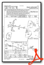
Instrument Approach Procedure (IAP) Charts


Nearby Airports with Instrument Procedures
| ID | Name | Heading / Distance | ||
|---|---|---|---|---|
 |
42J | Keystone Heights Airport | 051° | 14.9 |
|
X60 | Williston Regional Airport | 207° | 22.6 |
|
28J | Palatka Municipal/Lt Kay Larkin Field Airport | 093° | 30.5 |
|
KOCF | Ocala International-Jim Taylor Field Airport | 175° | 31.1 |
|
KLCQ | Lake City Gateway Airport | 331° | 33.5 |
|
KVQQ | Cecil Airport | 032° | 37.7 |
|
X35 | Marion County Airport | 188° | 38.0 |
|
KHEG | Herlong Recreational Airport | 034° | 42.7 |
|
KCTY | Cross City Airport | 265° | 43.7 |
|
KNIP | Jacksonville NAS (Towers Field) Airport | 043° | 45.0 |
|
KSGJ | St Augustine Airport | 071° | 51.2 |
|
KCGC | Crystal River/Davis Field Airport | 197° | 51.7 |
Airport Images

By: chabrier


