Login
Register


OKS
Garden County/King Rhiley Field Airport
Official FAA Data Effective 2026-02-19 0901Z
Chart Supplement

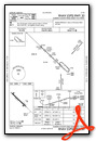
VFR Chart of KOKS
Sectional Charts at SkyVector.com
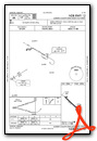
IFR Chart of KOKS
Enroute Charts at SkyVector.com
Location Information for KOKS
Coordinates: N41°24.11' / W102°21.38'Located 01 miles SW of Oshkosh, Nebraska on 181 acres of land. View all Airports in Nebraska.
Surveyed Elevation is 3394 feet MSL.
Operations Data
|
|
Airport Communications
| CTAF: | 122.800 |
|---|---|
| UNICOM: | 122.800 |
| AWOS-3 at OGA (31.6 SE): | 121.275 308-284-6573 |
| ASOS at SNY (33.7 SW): | 125.775 308-254-3525 |
| AWOS-3PT at GGF (42.6 SE): | 118.025 308-352-4689 |
- APCH/DEP CTL SVC PRVDD BY DENVER ARTCC (ZDV) ON FREQS 118.475/225.4 (BRUSH/B/ RCAG).
Nearby Navigation Aids
|
| ||||||||||||||||||||||||||||||||||||||||||||||||||||||||||||


Runway 12/30
| Dimensions: | 4699 x 60 feet / 1432 x 18 meters | |
|---|---|---|
| Surface: | Concrete in Good Condition | |
| Weight Limits: | S-12, D-12 | |
| Edge Lighting: | Medium Intensity | |
| Runway 12 | Runway 30 | |
| Coordinates: | N41°24.38' / W102°21.75' | N41°23.85' / W102°21.01' |
| Elevation: | 3394.1 | 3380.5 |
| Traffic Pattern: | Left | Left |
| Runway Heading: | 134° True | 314° True |
| Markings: | Non-Precision Instrument in good condition. | Non-Precision Instrument in good condition. |
| Glide Slope Indicator | P2L (3.00° Glide Path Angle) | P2L (3.00° Glide Path Angle) |
| REIL: | Yes | Yes |
Services Available
| Fuel: | 100LL (blue), Jet-A, Jet A+ |
|---|---|
| Transient Storage: | Hangars,Tiedowns |
| Airframe Repair: | MAJOR |
| Engine Repair: | MAJOR |
| Bottled Oxygen: | NONE |
| Bulk Oxygen: | NONE |
| Other Services: | CROP DUSTING SERVICES |
Ownership Information
| Ownership: | Publicly owned | |
|---|---|---|
| Owner: | GARDEN COUNTY ARPT AUTHORITY | |
| P.O. BOX 38 | ||
| OSHKOSH, NE 69154-0038 | ||
| (775) 224-6409 | ||
| Manager: | WHITNEY ROTHWELL | |
| 5648 HWY 27 | ||
| OSHKOSH, NE 69154-0038 | ||
| 308-650-0890 | ||
Other Remarks
- FOR CD CTC DENVER ARTCC AT 303-651-4257.
- 0LL 24 HR SELF SVC FUEL AVBL VIA CREDIT CARD SYSTEM.
- ACTIVATE MIRL, PAPI & REIL RWY 12 & 30 - CTAF.
Weather Minimums

Instrument Approach Procedure (IAP) Charts

Nearby Airports with Instrument Procedures
| ID | Name | Heading / Distance | ||
|---|---|---|---|---|
 |
KOGA | Searle Field Airport | 122° | 31.5 |
|
KSNY | Sidney Municipal/Lloyd W Carr Field Airport | 237° | 33.7 |
|
KGGF | Grant Municipal Airport | 138° | 42.6 |
|
KAIA | Alliance Municipal Airport | 332° | 43.9 |
|
KHEQ | Holyoke Airport | 175° | 50.1 |
|
KIBM | Kimball Municipal/Robert E Arraj Field Airport | 258° | 61.1 |
|
KBFF | Scottsbluff/Western Nebraska Regional/Wm B Heilig Field Airport | 297° | 62.5 |
|
KSTK | Sterling Municipal Airport | 221° | 62.7 |
|
KIML | Imperial Municipal Airport | 147° | 63.1 |
|
KLBF | North Platte Regional/Lee Bird Field Airport | 101° | 77.5 |
|
2V5 | Wray Municipal Airport | 176° | 78.2 |
|
2V6 | Yuma Municipal Airport | 191° | 79.4 |
Airport Images
Do you have a recent image of this airport? Upload it here!


