Login
Register
IKK
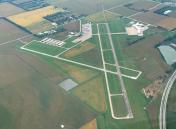
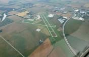
Greater Kankakee Airport
Official FAA Data Effective 2025-12-25 0901Z
VFR Chart of KIKK
Sectional Charts at SkyVector.com
IFR Chart of KIKK
Enroute Charts at SkyVector.com
Location Information for KIKK
Coordinates: N41°4.28' / W87°50.78'Located 03 miles S of Kankakee, Illinois on 950 acres of land. View all Airports in Illinois.
Surveyed Elevation is 629 feet MSL.
Operations Data
|
|
Airport Communications
| AWOS-3: | 128.475 Tel. 815-939-4044 |
|---|---|
| CTAF: | 123.000 |
| UNICOM: | 123.000 |
| AWOS-AV at C56 (20.0 NE): | 119.125 708-534-5256 |
| AWOS-3 at JOT (30.6 NW): | 119.975 815-730-9560 |
| AWOS-3P at RZL (31.0 E): | 119.175 219-866-7167 |
- APCH/DEP SVC PRVDD BY CHICAGO ARTCC (ZAU) ON FREQS 132.5/284.7 (KANKAKEE RCAG).
Nearby Navigation Aids
|
| ||||||||||||||||||||||||||||||||||||||||||||||||||||||||||||
Runway 04/22
| Dimensions: | 5981 x 100 feet / 1823 x 30 meters | |
|---|---|---|
| Surface: | Asphalt / Porous Friction Course in Good Condition | |
| Weight Limits: | S-60, D-95 | |
| Edge Lighting: | High Intensity | |
| Runway 04 | Runway 22 | |
| Coordinates: | N41°3.95' / W87°51.29' | N41°4.72' / W87°50.49' |
| Elevation: | 624.2 | 629.5 |
| Traffic Pattern: | Left | Left |
| Runway Heading: | 38° True | 218° True |
| Markings: | Precision Instrument in fair condition. | Non-Precision Instrument in fair condition. |
| Glide Slope Indicator | P4L (3.00° Glide Path Angle) | P4L (3.00° Glide Path Angle) |
| Approach Lights: | MALSR 1,400 Foot Medium-intensity Approach Lighting System with runway alignment indicator lights. | |
| REIL: | Yes | |
Runway 16/34
| Dimensions: | 4398 x 75 feet / 1341 x 23 meters | |
|---|---|---|
| Surface: | Asphalt / Grooved in Fair Condition | |
| Weight Limits: | S-30, D-40 | |
| Edge Lighting: | Medium Intensity | |
| Runway 16 | Runway 34 | |
| Coordinates: | N41°4.56' / W87°50.78' | N41°3.87' / W87°50.47' |
| Elevation: | 620.8 | 616.8 |
| Traffic Pattern: | Left | Left |
| Runway Heading: | 161° True | 341° True |
| Markings: | Non-Precision Instrument in good condition. | Non-Precision Instrument in good condition. |
| Glide Slope Indicator | P4L (3.00° Glide Path Angle) | P4L (3.00° Glide Path Angle) |
| Obstacles: | 58 ft Tree 712 ft from runway, 172 ft right of center | |
Services Available
| Fuel: | 100LL (blue), Jet-A |
|---|---|
| Transient Storage: | Hangars,Tiedowns |
| Airframe Repair: | NONE |
| Engine Repair: | NONE |
| Bottled Oxygen: | NONE |
| Bulk Oxygen: | NONE |
| Other Services: | AIR FREIGHT SERVICES,AIR AMBULANCE SERVICES,CARGO HANDLING SERVICES,PILOT INSTRUCTION,AIRCRAFT RENTAL,AIRCRAFT SALES |
Ownership Information
| Ownership: | Publicly owned | |
|---|---|---|
| Owner: | KANKAKEE VALLEY ARPT AUTH | |
| 813A E. 4000 S. RD | ||
| KANKAKEE, IL 60901 | ||
| 815-939-1422 | ||
| Manager: | JEFF BENOIT | EMAIL ADDRESS: ADMIN@KVAA.COM |
| 813A E. 4000 S. ROAD | ||
| KANKAKEE, IL 60901 | ||
| 815-939-1422 | ||
Other Remarks
- DEER & WATERFOWL ON & INVOF ARPT.
- PPR REQ FOR ULTRALIGHT OPS CTC AMGR. ULTRALIGHT ACT IN GRASS AREA W OF RWY 04/22 & E OF RWY 16/34.
- FOR CD IF UNA TO CTC ON FSS FREQ, CTC CHICAGO ARTCC AT 630-906-8921.
- CAN CONTACT CHICAGO CENTER ON GROUND 132.5.
- ACTVT MALSR RWY 04; REIL RWY 22; HIRL RWY 04/22; MIRL RWY 16/34 - CTAF. HIRL RWY 04/22 PRESET TO LOW INTST; TO INCR INTST - CTAF.
Weather Minimums
Instrument Approach Procedure (IAP) Charts
Nearby Airports with Instrument Procedures
| ID | Name | Heading / Distance | ||
|---|---|---|---|---|
 |
C56 | Bult Field Airport | 022° | 19.8 |
 |
50I | Kentland Municipal Airport | 134° | 26.7 |
 |
KRZL | Jasper County Airport | 103° | 31.0 |
 |
KIGQ | Lansing Municipal Airport | 027° | 31.3 |
 |
C09 | Morris Municipal/James R Washburn Field Airport | 309° | 33.5 |
 |
05C | Griffith-Merrillville Airport | 036° | 33.6 |
 |
KLOT | Lewis University Airport | 340° | 34.1 |
 |
KPNT | Pontiac Municipal Airport | 256° | 36.4 |
 |
KGYY | Gary/Chicago International Airport | 030° | 38.1 |
 |
3HO | Hobart Sky Ranch Airport | 041° | 39.2 |
 |
1C1 | Paxton Airport | 199° | 39.5 |
 |
1C5 | Bolingbrook's Clow International Airport | 341° | 39.6 |


