Login
Register


PEA
Pella Municipal Airport
Official FAA Data Effective 2025-11-27 0901Z
Chart Supplement

VFR Chart of KPEA
Sectional Charts at SkyVector.com
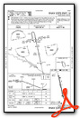
IFR Chart of KPEA
Enroute Charts at SkyVector.com
Location Information for KPEA
Coordinates: N41°24.07' / W92°56.75'Located 01 miles W of Pella, Iowa on 84 acres of land. View all Airports in Iowa.
Surveyed Elevation is 884 feet MSL.
ONLY APPLIES TO NON-TURBINE ACFT.
Operations Data
|
|
Airport Communications
| AWOS-3: | 118.875 Tel. 641-628-3459 |
|---|---|
| DES MOINES APPROACH: | 123.9 307.15 |
| DES MOINES DEPARTURE: | 123.9 307.15 |
| UNICOM: | 122.800 |
| CTAF: | 122.800 |
| AWOS-3 at OXV (9.8 SW): | 119.775 641-828-8406 |
| AWOS-3 at TNU (16.5 N): | 132.275 641-791-3302 |
| AWOS-3 at GGI (20.8 NE): | 120.725 641-236-9720 |
Nearby Navigation Aids
|
| ||||||||||||||||||||||||||||||||||||||||||


Runway 16/34
| Dimensions: | 5403 x 75 feet / 1647 x 23 meters | |
|---|---|---|
| Surface: | Concrete in Fair Condition | |
| Weight Limits: | 8 /R/D/W/T, S-30, D-40 | |
| Edge Lighting: | Medium Intensity | |
| Runway 16 | Runway 34 | |
| Coordinates: | N41°24.51' / W92°56.88' | N41°23.64' / W92°56.62' |
| Elevation: | 884.8 | 869.6 |
| Traffic Pattern: | Left | Left |
| Runway Heading: | 167° True | 347° True |
| Displaced Threshold: | 200 Feet | 201 Feet |
| Declared Distances: | TORA:5400 TODA:5400 ASDA:5200 LDA:5000 | TORA:5400 TODA:5400 ASDA:5200 LDA:5000 |
| Markings: | Non-Precision Instrument in fair condition. | Non-Precision Instrument in fair condition. |
| Glide Slope Indicator | P2L (3.30° Glide Path Angle) | P2L (3.00° Glide Path Angle) |
| REIL: | Yes | Yes |
| Obstacles: | 32 ft Tree 527 ft from runway, 191 ft left of center RWY 16 APCH SLP TO DTHR 22:1. |
31 ft Trees 474 ft from runway, 188 ft left of center RWY 34 APCH SLP TO DTHR 21:1. |
Services Available
| Fuel: | 100LL (blue), Jet-A |
|---|---|
| Transient Storage: | Hangars,Tiedowns |
| Airframe Repair: | MAJOR |
| Engine Repair: | MAJOR |
| Bottled Oxygen: | NOT AVAILABLE |
| Bulk Oxygen: | NOT AVAILABLE |
| Other Services: | PILOT INSTRUCTION,AIRCRAFT RENTAL |
Ownership Information
| Ownership: | Publicly owned | |
|---|---|---|
| Owner: | CITY OF PELLA | |
| 717 MAIN | ||
| PELLA, IA 50219 | ||
| 641-628-4173 | ||
| Manager: | SHANE VANDEVOORT | |
| 501 WEST 15TH STREET | EMAIL ADDRESS: SHANE@FLYCLASSICAVIATION.COM (ALL LOWER CASE) | |
| PELLA, IA 50219 | ||
| 641-628-9393 | CELL PHONE 641-780-0244 | |
Other Remarks
- FOR CD CTC DES MOINES ATCT AT 515-974-8016.
- MIRL RWY 16/34 PRESET LOW INTST; TO INCREASE INTST AND ACTVT PAPI RWY 16 & 34; REIL RWYS 16 & 34 - CTAF.
- ONLY APPLIES TO NON-TURBINE ACFT.
Weather Minimums


Instrument Approach Procedure (IAP) Charts

Nearby Airports with Instrument Procedures
| ID | Name | Heading / Distance | ||
|---|---|---|---|---|
 |
KOXV | Knoxville Municipal Airport | 231° | 9.7 |
|
KTNU | Newton Municipal-Earl Johnson Field Airport | 348° | 16.7 |
|
KGGI | Grinnell Regional Airport | 026° | 20.8 |
|
KOOA | Oskaloosa Municipal Airport | 117° | 23.0 |
|
4C8 | Albia Municipal Airport | 161° | 25.6 |
|
KOTM | Ottumwa Regional Airport | 127° | 28.6 |
|
KCNC | Chariton Municipal Airport | 219° | 29.6 |
|
KIKV | Ankeny Regional Airport | 302° | 32.9 |
|
KDSM | Des Moines International Airport | 284° | 33.3 |
|
I75 | Osceola Municipal Airport | 238° | 39.6 |
|
KTZT | Belle Plaine Municipal Airport | 045° | 41.3 |
|
KMIW | Marshalltown Municipal Airport | 001° | 42.7 |
Airport Images
Do you have a recent image of this airport? Upload it here!


