Login
Register


LQK
Pickens County Airport
Official FAA Data Effective 2026-01-22 0901Z
Chart Supplement

VFR Chart of KLQK
Sectional Charts at SkyVector.com
IFR Chart of KLQK
Enroute Charts at SkyVector.com
Location Information for KLQK
Coordinates: N34°48.60' / W82°42.17'Located 04 miles S of Pickens, South Carolina on 270 acres of land. View all Airports in South Carolina.
Surveyed Elevation is 1013 feet MSL.
Operations Data
|
|
Airport Communications
| AWOS-3: | 120.0 Tel. 864-843-5801 |
|---|---|
| GREER APPROACH: | 118.8 270.275 |
| GREER DEPARTURE: | 118.8 270.275 |
| CTAF: | 122.800 |
| UNICOM: | 122.800 |
| ASOS at CEU (12.1 SW): | 119.275 864-653-8855 |
| ATIS at GYH (16.4 E): | 127.325 |
| AWOS-3 at GYH (16.4 E): | 864-277-5674 |
- APCH/DEP SVC PRVDD BY ATLANTA ARTCC ON FREQS 134.8/379.95 (MOUNT OGLETHORPE RCAG) WHEN APCH CTL CLSD.
Nearby Navigation Aids
|
| ||||||||||||||||||||||||||||||||||||||||||||||||||||||||||||


Runway 05/23
| Dimensions: | 5002 x 100 feet / 1525 x 30 meters | |
|---|---|---|
| Surface: | Asphalt in Good Condition | |
| Weight Limits: | 29 /F/C/X/T, S-75, D-101 | |
| Edge Lighting: | Medium Intensity | |
| Runway 05 | Runway 23 | |
| Coordinates: | N34°48.30' / W82°42.52' | N34°48.90' / W82°41.83' |
| Elevation: | 963.7 | 1013.4 |
| Traffic Pattern: | Left | Left |
| Runway Heading: | 44° True | 224° True |
| Markings: | Non-Precision Instrument in good condition. | Non-Precision Instrument in good condition. |
| Glide Slope Indicator | P2L (3.00° Glide Path Angle) | P2L (3.00° Glide Path Angle) |
| Obstacles: | 93 ft Tree 3024 ft from runway, 404 ft left of center | |
Services Available
| Fuel: | 100LL (blue), Jet-A |
|---|---|
| Transient Storage: | Hangars,Tiedowns |
| Airframe Repair: | MINOR |
| Engine Repair: | MAJOR |
| Bottled Oxygen: | NONE |
| Bulk Oxygen: | NONE |
| Other Services: | PILOT INSTRUCTION,AIRCRAFT RENTAL |
Ownership Information
| Ownership: | Publicly owned | |
|---|---|---|
| Owner: | PICKENS COUNTY | |
| 222 MCDANIEL AVE; B-2 | ||
| PICKENS, SC 29671 | ||
| (864) 898-5844 | ||
| Manager: | CARLOS SALINAS | |
| 240 AIRPORT ROAD | ||
| 29657 | ||
| 864-843-5803 | ||
Other Remarks
- NOISE ABATEMENT PROC IN EFCT, PHONE 864-843-5803.
- FOR CD CTC GREER APCH AT 864-877-8275. WHEN GREER APCH CLSD, FOR CD CTC ATLANTA ARTCC AT 770-210-7692.
- ULTRALIGHT OPS AREA SOUTH OF RWY/REQ PRIOR CDN. CALL 864-843-5803 FOR INFO.
- ACTVT PAPI RWY 05 & 23; MIRL RWY 05/23 - CTAF.
Weather Minimums

Instrument Approach Procedure (IAP) Charts


Nearby Airports with Instrument Procedures
| ID | Name | Heading / Distance | ||
|---|---|---|---|---|
 |
KCEU | Oconee County Regional Airport | 227° | 12.2 |
|
KGYH | Donaldson Field Airport | 100° | 16.4 |
|
KGMU | Greenville Downtown Airport | 082° | 17.6 |
|
KAND | Anderson Regional Airport | 180° | 18.9 |
|
KGSP | Greenville Spartanburg International Airport | 077° | 24.4 |
|
KTOC | Toccoa Rg Letourneau Field Airport | 246° | 32.1 |
|
18A | Franklin-Hart Airport | 217° | 35.2 |
|
KSPA | Spartanburg Downtown Memorial/Simpson Field Airport | 079° | 37.4 |
|
KAVL | Asheville Regional Airport | 011° | 38.3 |
|
24A | Jackson County Airport | 320° | 39.3 |
|
KLUX | Laurens County Airport | 115° | 41.6 |
|
KGRD | Greenwood County Airport | 140° | 43.1 |
Airport Images
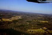
By: Matthias79


