Login
Register


PBX
Pike County/Hatcher Field Airport
Official FAA Data Effective 2026-01-22 0901Z
Chart Supplement

VFR Chart of KPBX
Sectional Charts at SkyVector.com
IFR Chart of KPBX
Enroute Charts at SkyVector.com
Location Information for KPBX
Coordinates: N37°33.71' / W82°33.99'Located 06 miles NW of Pikeville, Kentucky on 46 acres of land. View all Airports in Kentucky.
Surveyed Elevation is 1464 feet MSL.
Operations Data
|
|
Airport Communications
| AWOS-3PT: | 121.225 Tel. 606-437-6701 |
|---|---|
| CTAF: | 122.800 |
| UNICOM: | 122.800 |
| AWOS-3 at SJS (11.8 N): | 120.175 606-298-4143 |
| AWOS-3 at LNP (34.5 S): | 118.6 276-328-3727 |
| AWOS-3 at CPF (34.6 W): | 119.025 606-435-2452 |
- APCH/DEP SVC PRVDD BY INDIANAPOLIS ARTCC ON FREQS 126.575/257.850 (LYNCH RCAG).
Nearby Navigation Aids
|
| ||||||||||||||||||||||||||||||||||||||||||


Runway 09/27
| Dimensions: | 5356 x 100 feet / 1633 x 30 meters | |
|---|---|---|
| Surface: | Asphalt in Good Condition MULT DIPS IN RWY. | |
| Weight Limits: | 5 /F/D/X/T, S-30 | |
| Edge Lighting: | High Intensity | |
| Runway 09 | Runway 27 | |
| Coordinates: | N37°33.62' / W82°34.76' | N37°33.67' / W82°33.65' |
| Elevation: | 1448.1 | 1464.4 |
| Runway Heading: | 87° True | 267° True |
| Displaced Threshold: | 350 Feet | 350 Feet |
| Declared Distances: | TORA:5350 TODA:5350 ASDA:5000 LDA:4650 | TORA:5350 TODA:5350 ASDA:5000 LDA:4650 |
| Markings: | Non-Precision Instrument in fair condition. | Precision Instrument in fair condition. |
| Glide Slope Indicator | P4L (3.00° Glide Path Angle) PAPI UNUSBL BYD 8 DEG RIGHT OF CNTRLN. | P4L (3.00° Glide Path Angle) |
| REIL: | Yes | Yes |
| Obstacles: | 7 ft Tree 384 ft from runway, 239 ft right of center APCH RATIO 50:1 TO DTHR. |
13 ft Fence 220 ft from runway, 500 ft left of center APCH RATIO 43:1 TO DTHR |
Runway 02/20
CLSD INDEFLY. | ||
| Dimensions: | 3455 x 75 feet / 1053 x 23 meters | |
|---|---|---|
| Surface: | Asphalt in Failed Condition | |
| Weight Limits: | 5 /F/D/X/T, S-13 | |
| Runway 02 | Runway 20 | |
| Coordinates: | N37°33.54' / W82°33.75' | N37°34.08' / W82°33.55' |
| Elevation: | 1470.2 | 1458.4 |
| Runway Heading: | 16° True | 196° True |
Services Available
| Fuel: | 100LL (blue), Jet A+ |
|---|---|
| Transient Storage: | Tiedowns |
| Airframe Repair: | NOT AVAILABLE |
| Engine Repair: | NOT AVAILABLE |
| Bottled Oxygen: | NOT AVAILABLE |
| Bulk Oxygen: | NOT AVAILABLE |
| Other Services: | PILOT INSTRUCTION |
Ownership Information
| Ownership: | Publicly owned | |
|---|---|---|
| Owner: | PIKE COUNTY REG ARPT BOARD | BILL HICKMAN. |
| P.O. BOX 3353 | ||
| PIKEVILLE, KY 41502 | ||
| 606-432-5777 | ||
| Manager: | MATT RAY | |
| 331 AIRPORT DRIVE | ||
| PIKEVILLE, KY 41501 | ||
| 606-437-9548 | ||
Other Remarks
- FOR CD IF UNA TO CTC ON FSS FREQ, CTC INDIANAPOLIS ARTCC AT 317-247-2411.
- WINTER HR MON-FRI 0800-1900.
- ACTVT REIL RWY 09 & 27; PAPI RWY 09 & 27; HIRL RWY 09/27 - CTAF.
Weather Minimums


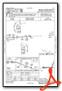
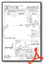
Instrument Approach Procedure (IAP) Charts

Nearby Airports with Instrument Procedures
| ID | Name | Heading / Distance | ||
|---|---|---|---|---|
 |
KSJS | Big Sandy Regional Airport | 343° | 11.8 |
|
KEBD | Southern West Virginia Regional Airport | 071° | 22.4 |
|
KLNP | Lonesome Pine Airport | 177° | 34.5 |
|
KCPF | Wendell H Ford Airport | 252° | 34.8 |
|
6L4 | Logan County Airport | 060° | 35.6 |
|
KJKL | Julian Carroll Airport | 273° | 35.9 |
|
KJFZ | Tazewell County Airport | 128° | 47.4 |
|
I16 | Kee Field Airport | 086° | 48.1 |
|
KHTS | Tri-State/Milton J Ferguson Field Airport | 000° | 48.3 |
|
12V | Ona Airpark Airport | 018° | 55.5 |
|
I35 | Tucker-Guthrie Memorial Airport | 222° | 56.7 |
|
KVJI | Virginia Highlands Airport | 153° | 58.3 |
Airport Images
Do you have a recent image of this airport? Upload it here!


