Login
Register
TA25
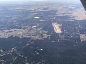
Cook Canyon Ranch Airport
Official FAA Data Effective 2026-01-22 0901Z
VFR Chart of TA25
Sectional Charts at SkyVector.com
IFR Chart of TA25
Enroute Charts at SkyVector.com
Location Information for TA25
Coordinates: N32°25.90' / W98°35.69'Located 03 miles WNW of Ranger, Texas on 20000 acres of land. View all Airports in Texas.
Surveyed Elevation is 1476 feet MSL.
Operations Data
|
|
Airport Communications
| CTAF: | 120.900 |
|---|---|
| AWOS-3PT at 6P9 (0.2 SW): | 118.8 254-647-3618 |
| AWOS-3PT at ETN (11.0 W): | 118.45 254-631-0493 |
| AWOS-4 at GZN (22.2 W): | 118.0 254-442-1185 |
- APCH/DEP SVC PRVDD BY FORT WORTH ARTCC (ZFW) ON FREQS 127.15/314.0 (DUBLIN RCAG).
Nearby Navigation Aids
|
| ||||||||||||||||||||||||||||||||||||||||||||||||||||||||||||
Runway 17/35
| Dimensions: | 5500 x 75 feet / 1676 x 23 meters | |
|---|---|---|
| Surface: | Concrete in Good Condition | |
| Edge Lighting: | Medium Intensity | |
| Runway 17 | Runway 35 | |
| Coordinates: | N32°26.35' / W98°35.78' | N32°25.46' / W98°35.59' |
| Elevation: | 1476.4 | 1472.9 |
| Markings: | Precision Instrument in fair condition. | Precision Instrument in fair condition. |
| Glide Slope Indicator | P4L (3.00° Glide Path Angle) | P4L (3.00° Glide Path Angle) |
| REIL: | Yes | Yes |
Ownership Information
| Ownership: | Privately Owned | |
|---|---|---|
| Owner: | COOK CANYON RANCH | |
| 8111 WEST CHESTER DR STE 900 | ||
| DALLAS, TX 75225 | ||
| (972) 655-8988 | ||
| Manager: | BRENT SCHMENK | OTHER CONTACT BRENT SCHMENK 214-351-7076 BSCHMENK@COOKCANYON.COM |
| 8111 WEST CHESTER DR STE 900 | ||
| DALLAS, TX 75225 | ||
| (972) 655-8988 | ||
Other Remarks
- ARPT HAS AWOS 3PT (6P9) ON AIRFIELD.
- FOR CD CTC FORT WORTH ARTCC AT 817-858-7584.
- ACTVT REIL RWY 17 & 35; PAPI RWY 17 & 35; MIRL RWY 17/35 - CTAF.
Nearby Airports with Instrument Procedures
| ID | Name | Heading / Distance | ||
|---|---|---|---|---|
 |
KETN | Eastland Municipal Airport | 264° | 11.0 |
 |
KGZN | Gregory M Simmons Memorial Airport | 259° | 22.1 |
 |
KBKD | Stephens County Airport | 318° | 22.8 |
 |
KSEP | Stephenville Clark Regional Airport | 121° | 24.9 |
 |
F35 | Possum Kingdom Airport | 015° | 30.5 |
 |
KMKN | Comanche County-City Airport | 180° | 30.6 |
 |
KMWL | Mineral Wells Regional Airport | 052° | 34.2 |
 |
T23 | Albany Municipal Airport | 297° | 38.3 |
 |
KGDJ | Granbury Regional Airport | 088° | 39.3 |
 |
KRPH | Graham Municipal Airport | 002° | 40.7 |
 |
KBWD | Brownwood Regional Airport | 205° | 42.4 |
 |
KWEA | Parker County Airport | 067° | 49.9 |


