



Login
Register
4AZ8
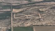
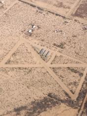
The Ultralight Strip Ultralight
Official FAA Data Effective 2026-10-01 0901Z
VFR Chart of 4AZ8
Sectional Charts at SkyVector.com
IFR Chart of 4AZ8
Enroute Charts at SkyVector.com
Location Information for 4AZ8
Coordinates: N32°17.68' / W111°20.67'Located 09 miles SW of Marana, Arizona on 58 acres of land. View all Airports in Arizona.
Estimated Elevation is 2120 feet MSL.
Operations Data
|
|
Airport Communications
| AWOS-3 at AVQ (9.6 NE): | 118.375 520-682-1397 |
|---|---|
| AWOS-3 at RYN (12.5 SE): | 520-578-0269 |
| ATIS at RYN (12.6 SE): | 133.35 |
Nearby Navigation Aids
|
| ||||||||||||||||||||||||||||||||||||||||||||||||


Runway 02/20
| Dimensions: | 1650 x 75 feet / 503 x 23 meters | |
|---|---|---|
| Surface: | Dirt | |
| Runway 02 | Runway 20 | |
Runway 14/32
| Dimensions: | 1650 x 75 feet / 503 x 23 meters | |
|---|---|---|
| Surface: | Dirt | |
| Runway 14 | Runway 32 | |
Runway 08/26
| Dimensions: | 850 x 75 feet / 259 x 23 meters | |
|---|---|---|
| Surface: | Dirt | |
| Runway 08 | Runway 26 | |
Ownership Information
| Ownership: | Privately Owned | |
|---|---|---|
| Owner: | CURTIS CARLSON | |
| 5000 N. AXTELL AVE | ||
| MARANA, AZ 85653 | ||
| Manager: | DAHL COOPER | |
| 4901 N. AXTELL AVE | ||
| MARANA, AZ 85653 | ||
| 520-682-7504 | ||
Other Remarks
- ULTRALIGHT TPA 400 FT AGL.
- FOR CD CTC TUCSON APCH AT 520-829-6121.
Nearby Airports with Instrument Procedures
| ID | Name | Heading / Distance | ||
|---|---|---|---|---|
 |
KAVQ | Marana Regional Airport | 042° | 9.4 |
|
KRYN | Ryan Field Airport | 136° | 12.6 |
|
KTUS | Tucson International Airport | 117° | 23.1 |
|
KDMA | Davis Monthan AFB Airport | 108° | 24.7 |
|
P08 | Coolidge Municipal Airport | 353° | 38.6 |
|
KCGZ | Casa Grande Municipal Airport | 331° | 45.0 |
|
KOLS | Nogales International Airport | 154° | 58.3 |
|
KIWA | Mesa Gateway Airport | 345° | 62.7 |
|
KCHD | Chandler Municipal Airport | 338° | 62.9 |
|
KFHU | Sierra Vista Municipal-Libby AAF Airport | 129° | 66.3 |
|
P19 | Stellar Airpark Airport | 334° | 66.7 |
|
P13 | San Carlos Apache Airport | 028° | 72.0 |
Airport Images
By: keeganm
By: MacPara



Comments
Unicom is 123.750
Unicom is 123.750