Login
Register
IL48
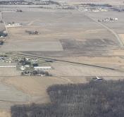
St Louis Metro-East/Shafer Field Airport
Official FAA Data Effective 2024-12-26 0901Z
VFR Chart of IL48
Sectional Charts at SkyVector.com
IFR Chart of IL48
Enroute Charts at SkyVector.com
Location Information for IL48
Coordinates: N38°43.97' / W89°48.39'Located 02 miles N of St Jacob, Illinois on 29 acres of land. View all Airports in Illinois.
Surveyed Elevation is 477 feet MSL.
Operations Data
|
|
Airport Communications
| SAINT LOUIS APPROACH: | 124.2 353.9 |
|---|---|
| SAINT LOUIS DEPARTURE: | 124.2 353.9 |
| CTAF: | 122.800 |
| UNICOM: | 122.800 |
| ATIS at BLV (11.4 S): | 128.7 |
| AWOS-3 at ALN (14.6 NW): | 128.0 618-259-7231 |
| ATIS at ALN (14.6 NW): | 128.0 |
Nearby Navigation Aids
|
| ||||||||||||||||||||||||||||||||||||||||||||||||||||||||||||
Runway 13/31
| Dimensions: | 2662 x 50 feet / 811 x 15 meters | |
|---|---|---|
| Surface: | Asphalt in Good Condition | |
| Edge Lighting: | Medium Intensity | |
| Runway 13 | Runway 31 | |
| Coordinates: | N38°44.13' / W89°48.59' | N38°43.82' / W89°48.20' |
| Elevation: | 477.0 | 469.0 |
| Traffic Pattern: | Left | Left |
| Runway Heading: | 136° True | 316° True |
| Displaced Threshold: | 127 Feet | |
| Markings: | Basic in fair condition. | Basic in fair condition. |
| Obstacles: | 16 ft Road 210 ft from runway, 126 ft right of center APCH SLOPE IS 21:1 TO DSPLCD THLD. |
65 ft Tree 1513 ft from runway, 225 ft right of center |
Services Available
| Fuel: | 100LL (blue) |
|---|---|
| Transient Storage: | Hangars,Tiedowns |
| Airframe Repair: | MINOR |
| Engine Repair: | MINOR |
| Bottled Oxygen: | NONE |
| Bulk Oxygen: | NOT AVAILABLE |
| Other Services: | PILOT INSTRUCTION,AIRCRAFT RENTAL,AIRCRAFT SALES |
Ownership Information
| Ownership: | Privately Owned | |
|---|---|---|
| Owner: | HAY CREEK REAL ESTATE LLC | |
| 9810 BEACON STREET | ||
| ST JACOB, IL 62281 | ||
| 618-644-5411 | ||
| Manager: | STEVEN COAD | |
| 9810 BEACON STREET | EMAIL ADDRESS: HYFLYER33@HOTMAIL.COM (ALL LOWER CASE) | |
| ST JACOB, IL 62281 | ||
| 618-644-5411 | CELL NUMBER: 618-920-1393 | |
Other Remarks
- THIS AIRPORT HAS BEEN SURVEYED BY THE NATIONAL GEODETIC SURVEY.
- MIL HEL OPNS PRIOR PERMISSION ONLY.
- FOR NOISE ABATEMENT PROCEDURES CTC AMGR 618-644-5411.
- FOR CD CTC ST LOUIS APCH AT 314-890-1017.
- MIRL RWY 13/31 PRESET ON LOW INTST; TO INCR INTST ACTVT - CTAF.
Nearby Airports with Instrument Procedures
| ID | Name | Heading / Distance | ||
|---|---|---|---|---|
 |
KBLV | Scott AFB/Midamerica St Louis Airport | 186° | 11.3 |
 |
KALN | St Louis Regional Airport | 310° | 14.7 |
 |
KCPS | St Louis Downtown Airport | 239° | 19.1 |
 |
KGRE | Greenville Airport | 072° | 21.0 |
 |
KSTL | St Louis Lambert International Airport | 272° | 26.5 |
 |
3LF | Litchfield Municipal Airport | 013° | 26.5 |
 |
KSET | St Charles County Regional/Smartt Field Airport | 292° | 31.5 |
 |
1H0 | Creve Coeur Airport | 269° | 33.0 |
 |
KVLA | Vandalia Municipal Airport | 062° | 33.8 |
 |
KSAR | Sparta Community-Hunter Field Airport | 171° | 35.4 |
 |
KENL | Centralia Municipal Airport | 110° | 36.1 |
 |
KSUS | Spirit of St Louis Airport | 264° | 39.9 |


