Login
Register


12G
Shelby Community Airport
Official FAA Data Effective 2026-02-19 0901Z
Chart Supplement

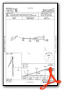
VFR Chart of 12G
Sectional Charts at SkyVector.com
IFR Chart of 12G
Enroute Charts at SkyVector.com
Location Information for 12G
Coordinates: N40°52.37' / W82°41.84'Located 02 miles WSW of Shelby, Ohio on 50 acres of land. View all Airports in Ohio.
Surveyed Elevation is 1120 feet MSL.
Operations Data
|
|
Airport Communications
| CLEVELAND APPROACH: | 128.35 360.65 |
|---|---|
| CLEVELAND DEPARTURE: | 128.35 360.65 |
| UNICOM: | 122.800 |
| CTAF: | 122.800 |
| ATIS at MFD (8.8 E): | 125.3 |
| ASOS at MFD (8.8 E): | 125.3 419-520-7277 |
| AWOS-3 at 17G (13.7 W): | 126.625 419-562-0279 |
- APCH/DEP SVC PRVDD BY CLEVELAND APCH (CLE) 0600-0100. APCH/DEP SVC PRVDD BY CLEVELAND ARTCC (ZOB) ON FREQS 134.9/269.475 (MANSFIELD RCAG) 0100-0600.
Nearby Navigation Aids
|
| ||||||||||||||||||||||||||||||||||||||||||||||||||||||||||||


Runway 18/36
| Dimensions: | 3174 x 50 feet / 967 x 15 meters | |
|---|---|---|
| Surface: | Asphalt in Poor Condition NMRS UNSEALED CRACKS & DTRTD PAVEMENT, HIGH FOD POTENTIAL. | |
| Weight Limits: | S-5 | |
| Edge Lighting: | Non-Standard NSTD LIRL DUE TO RWY 18 THR LGTS 220 FT FM RWY END; RWY LGTS 62 FT FM EAST EDGE & 47 FT FM WEST EDGE. | |
| Runway 18 | Runway 36 | |
| Coordinates: | N40°52.57' / W82°41.81' | N40°52.05' / W82°41.80' |
| Elevation: | 1117.5 | 1119.4 |
| Traffic Pattern: | Left | Left |
| Runway Heading: | 179° True | 359° True |
| Markings: | Basic in poor condition. | Basic in poor condition. |
| Obstacles: | 15 ft Road 201 ft from runway, 10 ft left of center +15 FT ROAD, 201 FT DIST, 10 FT L, 0:1 OBSTN CLNC SLP. ROAD, 165 FT DIST, 125 FT R. |
8 ft Crops 201 ft from runway, 75 ft right of center +8 FT CROPS, 0 FT DIST, 75 FT R, 0:1 OBSTN CLNC SLP. 0-8 FT SEASONAL CROPS, 75 FT L/R. |
Runway 03/21
| Dimensions: | 1890 x 125 feet / 576 x 38 meters | |
|---|---|---|
| Surface: | Turf in Good Condition | |
| Runway 03 | Runway 21 | |
| Coordinates: | N40°52.33' / W82°41.99' | N40°52.61' / W82°41.81' |
| Elevation: | 1120.4 | 1118.3 |
| Traffic Pattern: | Left | Left |
| Runway Heading: | 25° True | 205° True |
| Markings: | None | None |
| Obstacles: | 8 ft Crops 0 ft from runway, 65 ft right of center +8 FT CROPS, 0 FT DIST, 65 FT R, 0:1 OBSTN CLNC SLP. |
15 ft Road 240 ft from runway, 140 ft right of center |
Services Available
| Fuel: | NONE |
|---|---|
| Transient Storage: | Hangars,Tiedowns PRIOR CDN RQRD FOR TSNT HNGR. |
| Airframe Repair: | NOT AVAILABLE |
| Engine Repair: | NOT AVAILABLE |
| Bottled Oxygen: | NOT AVAILABLE |
| Bulk Oxygen: | NOT AVAILABLE |
Ownership Information
| Ownership: | Privately Owned | |
|---|---|---|
| Owner: | SHELBY AIRPORT LLC | |
| PO BOX 29 | MAILING ADS. | |
| SHELBY, OH 44875-0029 | ||
| 419-347-1185 | ||
| Manager: | DOUG SCHMIDT | INFO@SHELBYAIRPORT.COM. |
| 5085 STATE ROUTE 39 W | ||
| SHELBY, OH 44875-9061 | ||
| 419-347-1185 | OR 419-347-8543. | |
Other Remarks
- THIS AIRPORT HAS BEEN SURVEYED BY THE NATIONAL GEODETIC SURVEY.
- FOR CD CTC CLEVELAND APCH AT 216-352-2323, WHEN APCH CLSD CTC CLEVELAND ARTCC AT 440-774-0223/0490.
- CALM WIND RWY.
- FADED.
- FADED.
- ROPES NOT PRVDD FOR TSNT TIEDOWN.
Weather Minimums

Instrument Approach Procedure (IAP) Charts
Nearby Airports with Instrument Procedures
| ID | Name | Heading / Distance | ||
|---|---|---|---|---|
 |
KGQQ | Galion Municipal Airport | 189° | 7.3 |
|
KMFD | Mansfield Lahm Regional Airport | 110° | 8.8 |
|
8G1 | Willard Airport | 352° | 10.0 |
|
17G | Port Bucyrus/Crawford County Airport | 246° | 13.8 |
|
3G4 | Ashland County Airport | 084° | 20.2 |
|
4I9 | Morrow County Airport | 198° | 22.0 |
|
KMNN | Marion Municipal Airport | 227° | 22.7 |
|
5A1 | Norwalk/Huron County Airport | 016° | 23.3 |
|
16G | Seneca County Airport | 299° | 26.9 |
|
56D | Wyandot County Airport | 271° | 28.1 |
|
S24 | Sandusky County Regional Airport | 328° | 29.7 |
|
4I3 | Knox County Airport | 166° | 33.5 |
Airport Images
Do you have a recent image of this airport? Upload it here!


