Login
Register
6G4
Wynkoop Airport
Official FAA Data Effective 2025-12-25 0901Z
VFR Chart of 6G4
Sectional Charts at SkyVector.com
IFR Chart of 6G4
Enroute Charts at SkyVector.com
Location Information for 6G4
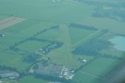
Coordinates: N40°21.90' / W82°29.74'Located 02 miles S of Mount Vernon, Ohio on 70 acres of land. View all Airports in Ohio.
Estimated Elevation is 1041 feet MSL.
Operations Data
|
|
Airport Communications
| CTAF: | 122.900 |
|---|---|
| AWOS-3PT at 4I3 (2.6 SW): | 126.05 740-397-6297 |
| AWOS-3PT at 4I9 (18.8 NW): | 121.4 419-947-1039 |
| ASOS at VTA (20.4 S): | 121.125 740-522-1066 |
Nearby Navigation Aids
|
| ||||||||||||||||||||||||||||||||||||||||||||||||||||||||||||
Runway 06/24
| Dimensions: | 3460 x 90 feet / 1055 x 27 meters | |
|---|---|---|
| Surface: | Turf in Good Condition | |
| Edge Lighting: | Non-Standard NSTD LIRL DUE TO NO THR LGTS. | |
| Runway 06 | Runway 24 | |
| Coordinates: | N40°21.77' / W82°30.07' | N40°22.04' / W82°29.41' |
| Elevation: | 1041.0 | 1041.0 |
| Traffic Pattern: | Left | Left |
| Obstacles: | 12 ft Crops 48 ft from runway, 45 ft left of center 60 FT TREE, 210 FT DIST, 45 FT R, 3:1. |
16 ft Road 0 ft from runway, 80 ft left of center |
Services Available
| Fuel: | NONE |
|---|---|
| Transient Storage: | Hangars,Tiedowns PRIOR CDN RQRD. |
| Airframe Repair: | NONE |
| Engine Repair: | NONE |
| Bottled Oxygen: | NONE |
| Bulk Oxygen: | NONE |
Ownership Information
| Ownership: | Privately Owned | |
|---|---|---|
| Owner: | BRIAN K WYNKOOP | |
| 9051 GRANVILLE RD | ||
| MOUNT VERNON, OH 43050-9411 | ||
| 740-358-2362 | ||
| Manager: | DOUG WHEELER | |
| 9051 GRANVILLE RD | ||
| MOUNT VERNON, OH 43050-9411 | ||
| 740-398-8106 | ||
Other Remarks
- -1 FT DITCH RWY 24 END 0 FT FM LEFT & RIGHT.
- DEER ON & INVOF ARPT.
- FOR CD CTC COLUMBUS APCH AT 614-338-8537.
- CALL AMGR FOR FLD CONDS NOV-APR.
- ORANGE CONES APRXLY 3000 FT.
- ORANGE CONES APRXLY 3000 FT.
- ROPES & ANCHORS NOT PRVDD.
- ACTVT NSTD LIRL - CALL AMGR.
- ACTVT ABN - CALL AMGR.
Nearby Airports with Instrument Procedures
| ID | Name | Heading / Distance | ||
|---|---|---|---|---|
 |
4I3 | Knox County Airport | 212° | 2.6 |
 |
4I9 | Morrow County Airport | 300° | 18.8 |
 |
KVTA | Licking County Regional Airport | 175° | 20.5 |
 |
KGQQ | Galion Municipal Airport | 335° | 25.5 |
 |
10G | Holmes County Airport | 067° | 26.8 |
 |
KMFD | Mansfield Lahm Regional Airport | 358° | 27.4 |
 |
KCMH | John Glenn Columbus International Airport | 219° | 28.6 |
 |
KDLZ | Delaware Municipal/Jim Moore Field Airport | 259° | 28.8 |
 |
I40 | Richard Downing Airport | 096° | 29.7 |
 |
KMNN | Marion Municipal Airport | 300° | 30.0 |
 |
KOSU | Ohio State University Airport | 237° | 31.6 |
 |
12G | Shelby Community Airport | 343° | 31.8 |


