Login
Register


77G
Marlette Township Airport
Official FAA Data Effective 2026-02-19 0901Z
Chart Supplement

VFR Chart of 77G
Sectional Charts at SkyVector.com
IFR Chart of 77G
Enroute Charts at SkyVector.com
Location Information for 77G
Coordinates: N43°18.71' / W83°5.46'Located 01 miles SW of Marlette, Michigan on 480 acres of land. View all Airports in Michigan.
Surveyed Elevation is 894 feet MSL.
Operations Data
|
|
Airport Communications
| CTAF: | 122.800 |
|---|---|
| UNICOM: | 122.800 |
| AWOS-3P at D95 (16.7 SW): | 134.050 810-664-5038 |
| AWOS-3P at CFS (17.8 NW): | 119.275 989-672-4182 |
| AWOS-3P at BAX (28.3 N): | 118.6 989-269-4137 |
- APCH/DEP SVC PRVDD BY CLEVELAND ARTCC (ZOB) ON FREQS 127.7/290.425 (FREELAND RCAG) .
Nearby Navigation Aids
|
| ||||||||||||||||||||||||||||||||||||||||||


Runway 10/28
| Dimensions: | 3795 x 75 feet / 1157 x 23 meters | |
|---|---|---|
| Surface: | Asphalt in Good Condition | |
| Edge Lighting: | Medium Intensity | |
| Runway 10 | Runway 28 | |
| Coordinates: | N43°18.62' / W83°5.84' | N43°18.62' / W83°4.99' |
| Elevation: | 871.7 | 879.2 |
| Traffic Pattern: | Left | |
| Runway Heading: | 89° True | 269° True |
| Markings: | Non-Precision Instrument in fair condition. | Non-Precision Instrument in fair condition. |
| Glide Slope Indicator | P2R (3.00° Glide Path Angle) | P2L (3.00° Glide Path Angle) |
| Obstacles: | 35 ft Tree 782 ft from runway, 324 ft right of center 0-8 FT SEASONAL CROPS, 200 FT DIST, 96 FT R. CTLG OBSTN EXCEEDS A 45 DEG SLP. |
17 ft Tree 200 ft from runway, 250 ft right of center |
Runway 01/19
| Dimensions: | 3500 x 75 feet / 1067 x 23 meters | |
|---|---|---|
| Surface: | Asphalt in Good Condition | |
| Edge Lighting: | Medium Intensity | |
| Runway 01 | Runway 19 | |
| Coordinates: | N43°18.52' / W83°5.52' | N43°19.10' / W83°5.47' |
| Elevation: | 870.8 | 894.9 |
| Traffic Pattern: | Left | Left |
| Runway Heading: | 4° True | 184° True |
| Markings: | Non-Precision Instrument in fair condition. | Non-Precision Instrument in fair condition. |
| Glide Slope Indicator | P2L (3.00° Glide Path Angle) | P2L (3.00° Glide Path Angle) |
| Obstacles: | 0-8 FT SEASONAL CROPS, 230 FT DIST, 120 FT R. |
10 ft Tree 287 ft from runway, 250 ft right of center |
Services Available
| Fuel: | 100LL (blue) |
|---|---|
| Transient Storage: | Hangars,Tiedowns FOR TSNT STORAGE CALL AMGR. |
| Airframe Repair: | NOT AVAILABLE |
| Engine Repair: | NOT AVAILABLE |
| Bottled Oxygen: | NOT AVAILABLE |
| Bulk Oxygen: | NOT AVAILABLE |
Ownership Information
| Ownership: | Publicly owned | |
|---|---|---|
| Owner: | MARLETTE TOWNSHIP | |
| 6725 AIRPORT RD | ||
| MARLETTE, MI 48453-8210 | ||
| 989-635-7772 | ||
| Manager: | PHIL ROACH | |
| 6725 AIRPORT RD | ||
| MARLETTE, MI 48453-8210 | ||
| 810-459-4674 | ||
Other Remarks
- FOR CD CTC CLEVELAND ARTCC AT 440-774-0224/0490.
- DEER & LRG BIRDS ON & INVOF ARPT.
- TRML BLDG ACES: 5-3-2-1*.
- 0LL AVBL H24 SELF SVC VIA CREDIT CARD.
- ACTVT PAPI RWY 01, 19, 10, & 28; MIRL RWY 01/19 & 10/28 - CTAF.
Weather Minimums

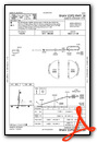
Instrument Approach Procedure (IAP) Charts


Nearby Airports with Instrument Procedures
| ID | Name | Heading / Distance | ||
|---|---|---|---|---|
 |
Y83 | Sandusky City Airport | 051° | 13.9 |
|
D95 | Dupont/Lapeer Airport | 208° | 16.7 |
|
KCFS | Tuscola Area Airport | 299° | 17.8 |
|
KBAX | Huron County Memorial Airport | 009° | 28.5 |
|
D98 | Romeo State Airport | 170° | 31.3 |
|
KPHN | St Clair County International Airport | 134° | 34.5 |
|
KHYX | Saginaw County/H W Browne Airport | 282° | 34.5 |
|
KFNT | Bishop International Airport | 234° | 35.4 |
|
57D | Ray Community Airport | 165° | 35.6 |
|
3CM | James Clements Municipal Airport | 292° | 37.9 |
|
CYZR | Sarnia Chris Hadfield Airport | 118° | 39.1 |
|
KPTK | Oakland County International Airport | 200° | 41.4 |
Airport Images

By: sunmanav8


