Login
Register


IER
Natchitoches Regional Airport
Official FAA Data Effective 2026-01-22 0901Z
Chart Supplement

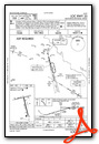
VFR Chart of KIER
Sectional Charts at SkyVector.com
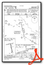
IFR Chart of KIER
Enroute Charts at SkyVector.com
Location Information for KIER
Coordinates: N31°44.14' / W93°5.95'Located 02 miles S of Natchitoches, Louisiana on 205 acres of land. View all Airports in Louisiana.
Estimated Elevation is 121 feet MSL.
Operations Data
|
|
Airport Communications
| AWOS-3: | 119.025 Tel. 318-352-1575 |
|---|---|
| POLK APPROACH: | 125.4 302.2 |
| POLK DEPARTURE: | 125.4 302.2 |
| CTAF: | 122.800 |
| UNICOM: | 122.800 |
| ASOS at AEX (36.7 SE): | 123.975 318-442-6583 |
| AWOS-3PT at 3F3 (39.4 NW): | 119.125 318-872-3537 |
| ASOS at POE (41.8 S): | 727-780-1210 |
Nearby Navigation Aids
|
| ||||||||||||||||||||||||||||||||||||||||||||||||||||||||||||


Runway 17/35
| Dimensions: | 5003 x 150 feet / 1525 x 46 meters | |
|---|---|---|
| Surface: | Asphalt in Good Condition | |
| Weight Limits: | S-30 | |
| Edge Lighting: | Medium Intensity | |
| Runway 17 | Runway 35 | |
| Coordinates: | N31°44.38' / W93°5.97' | N31°43.58' / W93°5.74' |
| Elevation: | 116.4 | 120.8 |
| Traffic Pattern: | Left | Left |
| Runway Heading: | 166° True | 346° True |
| Markings: | Non-Precision Instrument in fair condition. | Non-Precision Instrument in fair condition. |
| Glide Slope Indicator | P4L (3.00° Glide Path Angle) | P4L (3.00° Glide Path Angle) |
| Approach Lights: | ODALS Omnidirectional Approach Lighting System | |
| REIL: | Yes | |
| Obstacles: | 82 ft Tree 3600 ft from runway | 106 ft Trees 3612 ft from runway |
Runway 07/25
| Dimensions: | 4000 x 60 feet / 1219 x 18 meters | |
|---|---|---|
| Surface: | Asphalt in Good Condition | |
| Weight Limits: | S-21 | |
| Edge Lighting: | Medium Intensity | |
| Runway 07 | Runway 25 | |
| Coordinates: | N31°44.27' / W93°6.44' | N31°44.42' / W93°5.69' |
| Elevation: | 115.5 | 118.1 |
| Traffic Pattern: | Left | Left |
| Runway Heading: | 76° True | 256° True |
| Markings: | Basic in good condition. | Basic in good condition. |
| Glide Slope Indicator | P2L (3.00° Glide Path Angle) | P2L (3.00° Glide Path Angle) |
| REIL: | Yes | |
| Obstacles: | 98 ft Trees 2049 ft from runway, 142 ft right of center | 82 ft Tree 2091 ft from runway |
Services Available
| Fuel: | 100LL (blue), Jet A-1+ |
|---|---|
| Transient Storage: | Hangars,Tiedowns |
| Airframe Repair: | MAJOR |
| Engine Repair: | MAJOR |
| Bottled Oxygen: | NONE |
| Bulk Oxygen: | NONE |
| Other Services: | CROP DUSTING SERVICES,AIR AMBULANCE SERVICES,CHARTER SERVICE,PILOT INSTRUCTION,ANNUAL SURVEYING |
Ownership Information
| Ownership: | Publicly owned | |
|---|---|---|
| Owner: | CITY OF NATCHITOCHES | |
| PO BOX 37 | ||
| NATCHITOCHES, LA 71457 | ||
| 318-352-0994 | ||
| Manager: | JUSTIN FOSHEE | |
| 450 WALLENBERG DRIVE | ||
| NATCHITOCHES, LA 71457 | ||
| 318-352-0994 | ||
Other Remarks
- GCO AVBL ON FREQ 135.075 THRU FORT POLK APCH - 4 CLICKS; AND FSS - 6 CLICKS.
- FOR CD IF UNA VIA GCO CTC POLK APCH AT 337-531-2352.
- CTC ARPT MGR FOR DSNGD RAMP SPACE FOR PUB USE AT ARPT
- 0LL FUEL AVBL 24/7 WITH CC.
- ODALS RWY 35; REIL RWY 07 AND RWY 17 PRESET LOW INTST CONSLY, TO INCR INTST ACTVT - CTAF. MIRL RWY 17/35 AND RWY 7/25 PRESET LOW INTST DUSK TO DAWN, TO INCR INTST ACTVT - CTAF
Weather Minimums
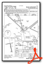
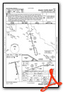
Instrument Approach Procedure (IAP) Charts
Nearby Airports with Instrument Procedures
| ID | Name | Heading / Distance | ||
|---|---|---|---|---|
 |
0R7 | The Red River Airport | 325° | 18.6 |
|
3R4 | Hart Airport | 239° | 22.8 |
|
0R5 | David G Joyce Airport | 058° | 26.3 |
|
F88 | Jonesboro Airport | 033° | 33.6 |
|
L39 | Leesville Airport | 200° | 36.2 |
|
KAEX | Alexandria International Airport | 130° | 37.3 |
|
3F3 | C E 'Rusty' Williams Airport | 300° | 39.6 |
|
KESF | Esler Regional Airport | 116° | 46.0 |
|
KRSN | Ruston Regional Airport | 029° | 53.3 |
|
KBAD | Barksdale AFB Airport | 328° | 54.1 |
|
F17 | Center Municipal Airport | 276° | 54.4 |
|
KMNE | Minden Airport | 349° | 55.4 |
Airport Images

By: Skydog222


