Login
Register


TYQ
Indianapolis Exec Airport
Official FAA Data Effective 2025-11-27 0901Z
Chart Supplement

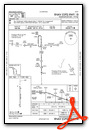
KTYQ Airport Diagram

VFR Chart of KTYQ
Sectional Charts at SkyVector.com
IFR Chart of KTYQ
Enroute Charts at SkyVector.com
Location Information for KTYQ
Coordinates: N40°1.72' / W86°15.08'Located 14 miles NW of Indianapolis, Indiana on 567 acres of land. View all Airports in Indiana.
Surveyed Elevation is 922 feet MSL.
Operations Data
|
|
Airport Communications
| AWOS-3PT: | 120.725 Tel. 317-769-3154 |
|---|---|
| INDIANAPOLIS APPROACH: | 124.65 ;ACTIVE RWY 05/23 AT IND 127.15 ;ACTIVE RWY 14/32 AT IND 317.8 |
| INDIANAPOLIS DEPARTURE: | 124.65 ;ACTIVE RWY 05/23 AT IND 127.15 ;ACTIVE RWY 14/32 AT IND 317.8 |
| CLEARANCE DELIVERY: | 118.175 |
| RACYR STAR: | 128.175 317.8 |
| CTAF: | 123.050 |
| UNICOM: | 123.050 |
| AWOS-3PT at UMP (10.9 SE): | 119.375 317-842-3911 |
| ASOS at EYE (12.0 S): | 121.575 317-329-1754 |
| AWOS-3 at 22L (14.9 S): | 127.075 317-964-9799 |
- APCH/DEP SVC PRVDD BY INDIANAPOLIS ATCT/TRACON ON 124.65 (ACTIVE RWY 05/23 AT IND) AND 127.15 (ACTIVE RWY 14/32 AT IND) AND ON 317.8.
Nearby Navigation Aids
|
| ||||||||||||||||||||||||||||||||||||||||||||||||||||||||||||


Runway 18/36
RWY 36 CALM/XWIND RWY. | ||
| Dimensions: | 7001 x 100 feet / 2134 x 30 meters | |
|---|---|---|
| Surface: | Concrete / Grooved in Excellent Condition | |
| Weight Limits: | 37 /R/B/W/T, S-45, D-90 | |
| Edge Lighting: | High Intensity | |
| Runway 18 | Runway 36 | |
| Coordinates: | N40°2.29' / W86°15.09' | N40°1.14' / W86°15.08' |
| Elevation: | 921.9 | 921.9 |
| Traffic Pattern: | Left | Left |
| Runway Heading: | 179° True | 359° True |
| Markings: | Non-Precision Instrument in good condition. | Precision Instrument in good condition. |
| Glide Slope Indicator | P4L (3.00° Glide Path Angle) | P4L (3.00° Glide Path Angle) |
| REIL: | Yes | Yes |
| Obstacles: | 24 ft Hangar 670 ft from runway, 540 ft right of center 10 FT CROPS 230 FT E OF RWY CNTRLN. |
35 ft Tree 1175 ft from runway, 200 ft right of center |
Services Available
| Fuel: | 100LL (blue), Jet-A, Jet A+ |
|---|---|
| Transient Storage: | Hangars,Tiedowns |
| Airframe Repair: | MAJOR |
| Engine Repair: | MAJOR |
| Bottled Oxygen: | HIGH |
| Bulk Oxygen: | HIGH/LOW |
| Other Services: | AIR FREIGHT SERVICES,AIR AMBULANCE SERVICES,AVIONICS,CARGO HANDLING SERVICES,CHARTER SERVICE,PILOT INSTRUCTION,AIRCRAFT RENTAL,AIRCRAFT SALES |
Ownership Information
| Ownership: | Publicly owned | |
|---|---|---|
| Owner: | HAMILTON COUNTY AIRPORT AUTHORITY | |
| 11329 E. STATE RD 32 | ||
| ZIONSVILLE, IN 46077 | ||
| (317) 385-3015 | ||
| Manager: | SAM SACHS | |
| 11329 E. STATE RD 32 | ||
| ZIONSVILLE, IN 46077 | ||
| 317-385-3015 | ||
Other Remarks
- BIRDS ON & INVOF ARPT
- FOR CD CTC INDIANAPOLIS APCH AT 317-227-5743.
- COND NOT MNT 2000-0600.
- REMOTE CTL ACFT ACT 0.1 NM W OF RWY 18/36 SFC-400 FT.
- FUEL & SVC - 130.4
- 0LL 100LL SELF SVC H24 WITH CREDIT CARD.
- ACTVT REIL RWY 18 & 36; HIRL RWY 18/36 - CTAF. HIRL RWY 18/36 PRESET MED INTST DUSK - DAWN; INCR INTST- CTAF. PAPI RWY 18 & 36 OPR CONSLY.
Weather Minimums

Standard Terminal Arrival (STAR) Charts

Instrument Approach Procedure (IAP) Charts


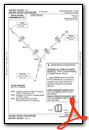
Departure Procedure (DP) Charts


Nearby Airports with Instrument Procedures
| ID | Name | Heading / Distance | ||
|---|---|---|---|---|
 |
5I4 | Sheridan Airport | 009° | 9.1 |
|
KUMP | Indianapolis Metro Airport | 120° | 11.0 |
|
KEYE | Eagle Creek Airpark Airport | 189° | 12.0 |
 |
8A4 | Indianapolis Downtown Heliport | 163° | 16.4 |
|
KIND | Indianapolis International Airport | 186° | 18.8 |
|
KMQJ | Indianapolis Regional Airport | 124° | 19.8 |
|
2R2 | Hendricks County-Gordon Graham Field Airport | 211° | 19.8 |
|
KFKR | Frankfort Clinton County Regional Airport | 315° | 20.5 |
|
KHFY | Indy South Greenwood Airport | 162° | 25.2 |
|
KAID | Anderson Regional Airport | 080° | 29.8 |
|
KCFJ | Crawfordsville Regional Airport | 264° | 31.0 |
|
KOKK | Kokomo Municipal Airport | 016° | 31.2 |


