Login
Register


AIO
Atlantic Municipal Airport
Official FAA Data Effective 2026-02-19 0901Z
Chart Supplement

VFR Chart of KAIO
Sectional Charts at SkyVector.com
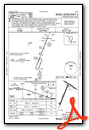
IFR Chart of KAIO
Enroute Charts at SkyVector.com
Location Information for KAIO
Coordinates: N41°24.23' / W95°2.92'Located 02 miles W of Atlantic, Iowa on 127 acres of land. View all Airports in Iowa.
Surveyed Elevation is 1164 feet MSL.
Operations Data
|
|
Airport Communications
| AWOS-3: | 127.825 Tel. 712-243-2748 |
|---|---|
| UNICOM: | 122.700 |
| CTAF: | 122.700 |
| AWOS-3 at HNR (16.8 NW): | 118.325 712-744-4400 |
| AWOS-3 at ADU (18.8 N): | 118.075 712-563-2101 |
| AWOS-3P at RDK (25.5 SW): | 123.925 712-623-3220 |
- APCH/DEP SVC PRVDD BY MINNEAPOLIS ARTCC ON FREQS 119.6/290.4 (OMAHA RCAG).
Nearby Navigation Aids
|
| ||||||||||||||||||||||||||||||||||||||||||||||||


Runway 02/20
| Dimensions: | 5000 x 75 feet / 1524 x 23 meters | |
|---|---|---|
| Surface: | Concrete in Good Condition | |
| Weight Limits: | 6 /R/C/W/U | |
| Edge Lighting: | Medium Intensity | |
| Runway 02 | Runway 20 | |
| Coordinates: | N41°23.71' / W95°3.25' | N41°24.47' / W95°2.84' |
| Elevation: | 1145.9 | 1149.0 |
| Runway Heading: | 22° True | 202° True |
| Markings: | Non-Precision Instrument in fair condition. | Non-Precision Instrument in fair condition. |
| Glide Slope Indicator | P2L (3.00° Glide Path Angle) | P2L (3.00° Glide Path Angle) |
| REIL: | Yes | Yes |
Runway 12/30
| Dimensions: | 3132 x 75 feet / 955 x 23 meters | |
|---|---|---|
| Surface: | Asphalt in Good Condition | |
| Weight Limits: | 6 /F/C/X/U, S-12 | |
| Edge Lighting: | Medium Intensity | |
| Runway 12 | Runway 30 | |
| Coordinates: | N41°24.59' / W95°3.03' | N41°24.31' / W95°2.45' |
| Elevation: | 1164.9 | 1143.8 |
| Traffic Pattern: | Left | Left |
| Runway Heading: | 123° True | 303° True |
| Displaced Threshold: | 290 Feet | |
| Declared Distances: | TORA:3132 TODA:3132 ASDA:3132 LDA:2842 | TORA:3132 TODA:3132 ASDA:3132 LDA:3132 |
| Markings: | Non-Precision Instrument in good condition. | Non-Precision Instrument in good condition. |
| Obstacles: | 73 ft Tree 1287 ft from runway, 75 ft right of center APCH SLOPE 20:1 TO DSPLCD THLD. 13 FT ROAD @ 80 FT ON CNTRLN. |
15 ft Brush 385 ft from runway, 110 ft right of center |
Services Available
| Fuel: | 100LL (blue), Jet-A |
|---|---|
| Transient Storage: | Hangars,Tiedowns |
| Airframe Repair: | MINOR |
| Engine Repair: | MINOR |
| Bottled Oxygen: | NONE |
| Bulk Oxygen: | NONE |
| Other Services: | PILOT INSTRUCTION,AIRCRAFT RENTAL,AIRCRAFT SALES |
Ownership Information
| Ownership: | Publicly owned | |
|---|---|---|
| Owner: | CITY OF ATLANTIC | |
| 23 E. 4TH ST. | ||
| ATLANTIC, IA 50022 | ||
| 712-243-4810 | ||
| Manager: | BARRY REID | |
| 59706 AIRPORT RD | EMAIL ADDRESS: AIRWORKSAIO@GMAIL.COM (ALL LOWER CASE) | |
| ATLANTIC, IA 50022 | ||
| 712-243-3056 | ||
Other Remarks
- CREEK 200 FT FM RY END 30.
- FOR CD CTC MINNEAPOLIS ARTCC AT 651-463-5588.
- ACTVT MIRL RYS 02/20 & 12/30 AND REIL AND PAPI RYS 02/20- CTAF.
Weather Minimums


Instrument Approach Procedure (IAP) Charts

Nearby Airports with Instrument Procedures
| ID | Name | Heading / Distance | ||
|---|---|---|---|---|
 |
KHNR | Harlan Municipal Airport | 309° | 17.0 |
|
KADU | Audubon County Airport | 017° | 18.8 |
|
KRDK | Red Oak Municipal Airport | 202° | 25.4 |
|
KGFZ | Greenfield Municipal Airport | 099° | 27.7 |
|
KCRZ | Corning Municipal Airport | 151° | 27.9 |
|
KGCT | Guthrie County Regional Airport | 058° | 32.4 |
|
KCBF | Council Bluffs Municipal Airport | 255° | 33.2 |
|
KDNS | Denison Municipal Airport | 337° | 38.0 |
|
KCSQ | Creston Municipal Airport | 126° | 38.6 |
|
KOMA | Eppley Airfield Airport | 261° | 38.7 |
|
KCIN | Arthur N Neu Airport | 016° | 40.3 |
|
KICL | Schenck Field Airport | 178° | 40.9 |
Airport Images
Do you have a recent image of this airport? Upload it here!


Comments
Great place for a break.
Great place for a break. Very nice terminal complete with planning room, wifi, vending machines, and comfortable pilot areas. Friendly FBO. Talented female pilots that can dance and play the saxaphone. Several Ag aircraft based at the airport and transient Ag aircraft in season, so it can get busy. Good prices on 100LL and Jet-A. Stopped twice and will stop again when I am in the area.
Great fuel stop
The FBO staff was very friendly and had a nice place to take a break. I would stop here again.