Login
Register


SC10
State Line Ultraport/Flightpark Ultralight
Official FAA Data Effective 2023-11-30 0901Z
VFR Chart of SC10
Sectional Charts at SkyVector.com
IFR Chart of SC10
Enroute Charts at SkyVector.com
Location Information for SC10
Coordinates: N35°10.71' / W81°49.07'Located 05 miles NE of Chesnee, South Carolina on 10 acres of land. View all Airports in South Carolina.
Estimated Elevation is 870 feet MSL.
Operations Data
|
|
Airport Communications
| AWOS-3 at EHO (11.7 NE): | 118.425 704-487-0100 |
|---|---|
| AWOS-3 at FQD (16.1 N): | 118.275 828-287-6498 |
| AWOS-3 at SPA (17.2 SW): | 133.925 864-587-2529 |
Nearby Navigation Aids
|
| ||||||||||||||||||||||||||||||||||||||||||||||||||||||||||||


Runway 09/27
| Dimensions: | 1500 x 50 feet / 457 x 15 meters | |
|---|---|---|
| Surface: | Turf | |
| Runway 09 | Runway 27 | |
Ownership Information
| Ownership: | Privately Owned | |
|---|---|---|
| Owner: | MAC JAMES | OWNER PAUL SCRUGGS - LEASED BY MAC JAMES. |
| 117 CHESTERFIELD RD | ||
| MOORESBORO, NC 28114 | ||
| 828-289-0650 | ||
| Manager: | MAC JAMES | |
| 117 CHESTERFIELD RD | ||
| MOORESBORO, NC 28114 | ||
| 828-289-0650 | ||
Other Remarks
- (A70) COURTESY TRUCK AVAILABLE FOR FUEL.
- FOR CD CTC ATLANTA ARTCC AT 770-210-7692.
- (ARPT STATUS) ARPT CLSD INDEFLY.
Nearby Airports with Instrument Procedures
| ID | Name | Heading / Distance | ||
|---|---|---|---|---|
 |
KEHO | Shelby-Cleveland County Regional Airport | 066° | 11.6 |
|
KFQD | Rutherford County/Marchman Field Airport | 338° | 16.0 |
|
KSPA | Spartanburg Downtown Memorial/Simpson Field Airport | 203° | 17.1 |
|
KGSP | Greenville Spartanburg International Airport | 229° | 26.0 |
|
35A | Union County, Troy Shelton Field Airport | 163° | 30.7 |
|
KAKH | Gastonia Municipal Airport | 087° | 32.9 |
|
KGMU | Greenville Downtown Airport | 233° | 32.9 |
|
KIPJ | Lincolnton-Lincoln County Regional Airport | 060° | 37.0 |
|
KGYH | Donaldson Field Airport | 227° | 37.3 |
|
KDCM | Chester Catawba Regional Airport | 127° | 38.5 |
|
KAVL | Asheville Regional Airport | 293° | 38.8 |
|
KUZA | Rock Hill/York County/Bryant Field Airport | 106° | 39.2 |
Airport Images
Do you have a recent image of this airport? Upload it here!


Comments
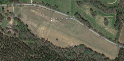
Airport no longer exists, it
Airport no longer exists, it was sold out to a real estate company by the name of Metcalf Lands, then was sold to an individual for $57,800 last year, I rode my bike past the area sometime back in the summer of last year and found that the double hangars were torn down along with the house that was with the property, here is a picture of the place.