Login
Register


AAF
Apalachicola Regional-Cleve Randolph Field Airport
Official FAA Data Effective 2025-12-25 0901Z
Chart Supplement

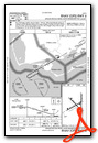
VFR Chart of KAAF
Sectional Charts at SkyVector.com
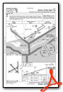
IFR Chart of KAAF
Enroute Charts at SkyVector.com
Location Information for KAAF
Coordinates: N29°43.65' / W85°1.64'Located 02 miles W of Apalachicola, Florida on 1100 acres of land. View all Airports in Florida.
Surveyed Elevation is 19 feet MSL.
Operations Data
|
|
Airport Communications
| ASOS: | 119.925 Tel. 850-203-0001 |
|---|---|
| TYNDALL APPROACH: | 124.15 ;ABV 5000 FT 125.2 ;ABV 5000 FT 392.1 ;ABV 5000 FT |
| TYNDALL DEPARTURE: | 124.15 ;ABV 5000 FT 125.2 ;ABV 5000 FT 392.1 ;ABV 5000 FT |
| IC: | 124.15 ;ABV 5000 FT |
| CTAF: | 122.800 |
| UNICOM: | 122.800 |
| ATIS at PAM (35.1 NW): | 254.4 |
| AWOS-3PT at F95 (45.9 N): | 119.35 850-674-1347 |
| ASOS at TLH (53.0 NE): | 119.45 850-203-0697 |
- APCH/DEP SVC PRVDD BY JACKSONVILLE ARTCC ON FREQS 120.825/379.3 (PANAMA CITY RCAG) WHEN TYNDALL APCH CTL IS CLSD.
Nearby Navigation Aids
|
| ||||||||||||||||||||||||||||||||||||


Runway 14/32
| Dimensions: | 5425 x 150 feet / 1654 x 46 meters | |
|---|---|---|
| Surface: | Concrete in Fair Condition | |
| Weight Limits: | 12 /R/B/X/T | |
| Edge Lighting: | Medium Intensity | |
| Runway 14 | Runway 32 | |
| Coordinates: | N29°43.97' / W85°2.08' | N29°43.33' / W85°1.36' |
| Elevation: | 15.1 | 18.2 |
| Traffic Pattern: | Left | Left |
| Runway Heading: | 135° True | 315° True |
| Markings: | Non-Precision Instrument in fair condition. | Non-Precision Instrument in fair condition. |
| Glide Slope Indicator | P2L (3.00° Glide Path Angle) | P2L (3.00° Glide Path Angle) |
| Obstacles: | 23 ft Trees 975 ft from runway, 20 ft right of center | |
Runway 06/24
| Dimensions: | 5271 x 150 feet / 1607 x 46 meters | |
|---|---|---|
| Surface: | Concrete in Fair Condition | |
| Weight Limits: | 12 /R/B/X/T | |
| Edge Lighting: | Medium Intensity | |
| Runway 06 | Runway 24 | |
| Coordinates: | N29°43.34' / W85°2.25' | N29°43.77' / W85°1.38' |
| Elevation: | 19.4 | 19.3 |
| Runway Heading: | 60° True | 240° True |
| Displaced Threshold: | 217 Feet | |
| Markings: | Non-Precision Instrument in fair condition. | Non-Precision Instrument in fair condition. |
| Glide Slope Indicator | P2L (3.00° Glide Path Angle) | P2L (3.00° Glide Path Angle) |
| Obstacles: | 59 ft Trees 1390 ft from runway, 185 ft right of center | 45 ft Trees 880 ft from runway, 215 ft left of center |
Runway 18/36
| Dimensions: | 5251 x 150 feet / 1601 x 46 meters | |
|---|---|---|
| Surface: | Concrete in Fair Condition | |
| Weight Limits: | 12 /R/B/X/T | |
| Runway 18 | Runway 36 | |
| Coordinates: | N29°44.19' / W85°1.38' | N29°43.32' / W85°1.39' |
| Elevation: | 15.1 | 19.5 |
| Runway Heading: | 180° True | 0 |
| Displaced Threshold: | 502 Feet | |
| Markings: | Basic in fair condition. | Basic in fair condition. |
| Obstacles: | 66 ft Trees 1200 ft from runway, 250 ft left of center RWY 18 APCH RATIO 20:1 TO AER. |
41 ft Trees 515 ft from runway, 200 ft left of center RWY 36 APCH RATIO TO THE DTHR IS 25:1. |
Services Available
| Fuel: | 100LL (blue), Jet-A |
|---|---|
| Transient Storage: | Hangars,Tiedowns |
| Airframe Repair: | MAJOR |
| Engine Repair: | MAJOR |
| Bottled Oxygen: | NONE |
| Bulk Oxygen: | NONE |
| Other Services: | AVIONICS,CHARTER SERVICE,PILOT INSTRUCTION,AIRCRAFT RENTAL,AIRCRAFT SALES |
Ownership Information
| Ownership: | Publicly owned | |
|---|---|---|
| Owner: | FRANKLIN COUNTY | |
| 33 MARKET STREET, SUITE 203 | ||
| APALACHICOLA, FL 32320-2317 | ||
| 850-653-9783 | ||
| Manager: | STEVE KIRSCHENBAUM | |
| 8 AIRPORT ROAD | ||
| APALACHICOLA, FL 32320-2317 | ||
| 850-290-8282 | ||
Other Remarks
- FOR CD CTC TYNDALL APCH AT 850-283-2900 OR 850-283-3353, WHEN APCH CLSD CTC JACKSONVILLE ARTCC AT 904-845-1592.
- UNLGTD OBSTNS IN APCH; 60 FT TREES 1390 FT BFR AER.
- UNLGTD OBSTNS IN APCH; 67 FT TREES 1200 FT BFR AER.
- UNLGTD OBSTNS IN APCH; 47 FT TREES 985 FT BFR AER.
- ACTVT PAPI RWY 6, 24, 14, & 32; MIRL RWY 06/24 & 14/32 - CTAF.
Weather Minimums
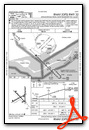
Instrument Approach Procedure (IAP) Charts

Nearby Airports with Instrument Procedures
| ID | Name | Heading / Distance | ||
|---|---|---|---|---|
 |
KPAM | Tyndall AFB Airport | 305° | 35.1 |
|
KTLH | Tallahassee International Airport | 041° | 53.3 |
|
KECP | Northwest Florida Beaches International Airport | 313° | 55.0 |
|
2J9 | Quincy Municipal Airport | 025° | 57.5 |
|
KMAI | Marianna Municipal Airport | 353° | 67.0 |
|
KBCR | Tri-County Airport | 336° | 73.2 |
|
17J | Donalsonville Municipal Airport | 005° | 77.0 |
|
KBGE | Decatur County Industrial Air Park Airport | 015° | 77.2 |
|
KFPY | Perry-Foley Airport | 074° | 78.2 |
|
70J | Cairo-Grady County Airport | 032° | 82.9 |
|
54J | Defuniak Springs Airport | 316° | 83.9 |
|
KDTS | Destin Exec Airport | 298° | 85.3 |
Airport Images
Do you have a recent image of this airport? Upload it here!


