
Login
Register


5V4
Calhan Airport
Official FAA Data Effective 2025-12-25 0901Z
Chart Supplement

VFR Chart of 5V4
Sectional Charts at SkyVector.com
IFR Chart of 5V4
Enroute Charts at SkyVector.com
Location Information for 5V4
Coordinates: N39°2.90' / W104°17.58'Located 01 miles N of Calhan, Colorado on 66 acres of land. View all Airports in Colorado.
Surveyed Elevation is 6450 feet MSL.
Operations Data
|
|
Airport Communications
| UNICOM: | 122.725 |
|---|---|
| CTAF: | 122.725 |
| AWOS-3PT at FLY (14.3 SW): | 118.450 719-683-5371 |
| AWOS-3 at MNH (19.2 NW): | 134.375 303-648-3479 |
| ASOS at COS (23.4 SW): | 125.0 719-694-7502 |
Nearby Navigation Aids
|
| ||||||||||||||||||||||||||||||||||||||||||||||||


Runway 17/35
| Dimensions: | 4565 x 50 feet / 1391 x 15 meters WIDTH VARIES FM 50 FT TO 100 FT. | |
|---|---|---|
| Surface: | Turf-Gravel in Good Condition RY 17 FIRST 1250 FT 45 FT WIDE ARTIFICIAL TURF. | |
| Edge Lighting: | Non-Standard RY 17/35 NSTD LIRL. NORTH 3000 FT RY LIGHTED. | |
| Runway 17 | Runway 35 | |
| Coordinates: | N39°3.27' / W104°17.58' | N39°2.52' / W104°17.58' |
| Traffic Pattern: | Left | Right |
| Runway Heading: | 180° True | 0 |
| Glide Slope Indicator | TRIL | |
| Obstacles: | 22 ft Pole 432 ft from runway, 96 ft right of center | 35 ft Trees 116 ft from runway, 53 ft left of center |
Services Available
| Fuel: | NONE |
|---|---|
| Transient Storage: | Hangars,Tiedowns |
| Airframe Repair: | NONE |
| Engine Repair: | NONE |
| Bottled Oxygen: | NONE |
| Bulk Oxygen: | NONE |
Ownership Information
| Ownership: | Privately Owned | |
|---|---|---|
| Owner: | EDWARD GLASER | |
| PO BOX 38 | ||
| CALHAN, CO 80808 | ||
| 719-347-2338 | ||
| Manager: | DAVID E GLASER | |
| PO BOX 69 | ||
| CALHAN, CO 80808 | ||
| 719-338-2149 | ALTERNATE NUMBER 719-347-2338 | |
Other Remarks
- S END OF RY HAS SIDE SLOPE. -6 FT DITCH 40 FT W OF CNTRLN. GROUND RISES ON EAST SIDE OF RY.
- BE ALERT; INTENSIVE USAF STUDENT TRAINING IN VICINITY OF COLORADO SPRINGS & PUEBLO COLORADO.
- RY 17/35 HAS +15 FT ROAD 110 FT FM & PARALLEL TO RY CNTRLN W SIDE OF RY - FULL LENGTH.
- RWY 35 HAS 4 FT FENCE 200 FT FM THLD OB; APPX 20 FT TREES 70 FT WEST OF CNTRLN FOR FIRST 500 FT OF RWY; APPX 25 FT P-LINE 850 FT FM THLD OB; APPX 2 FT BURM AT RWY THLD.
- FOR CD CTC COLORADO SPRINGS APCH AT 719-556-9105.
- AEROBATIC PRACTICE AREA ONE-HALF MILE W OF RY 17/35 300 FT AGL TO 10000 FT MSL.
- VEHICLES CROSSING RY.
- RWY 17 HAS 25 FT P-POLE 400 FT FM THLD, 110 FT R OF CNTRLN.
- DUSK-DAWN. ACTVT NSTD LIRL RY 17/35 & VASI RY 17 - CTAF.
Nearby Airports with Instrument Procedures
| ID | Name | Heading / Distance | ||
|---|---|---|---|---|
 |
KFLY | Meadow Lake Airport | 244° | 14.4 |
|
KCOS | City of Colorado Springs Municipal Airport | 232° | 24.0 |
|
KLIC | Limon Municipal Airport | 064° | 32.3 |
|
KAPA | Centennial Airport | 320° | 40.6 |
|
KBKF | Buckley Space Force Base Airport | 331° | 44.6 |
|
KCFO | Colorado Air and Space Port Airport | 345° | 45.6 |
|
KPUB | Pueblo Memorial Airport | 192° | 46.5 |
|
KDEN | Denver International Airport | 340° | 51.9 |
|
1V6 | Fremont County Airport | 226° | 53.3 |
|
KBJC | Rocky Mountain Metro Airport | 323° | 64.2 |
|
KEIK | Erie Municipal Airport | 328° | 67.5 |
|
KLHX | La Junta Municipal Airport | 148° | 70.3 |




Comments
You too can land on Astrotruf
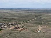
You too can land on Astrotruf! 1,200' at the north end of the runway is covered with the stuff. I found it nice to land on. The remainder of the runway is slightly soft dirt in good condition. There is a bit of a lip and a small crater at the end of the Astrotruf on the north end.
Beyond that, no services or fuel at the airport. It's a short walk to town.
Pages